another report


www.republicworld.com
On Monday, December 27, Scientists in China stated that Beijing-3, a small one-ton commercial
satellite launched by China in June,
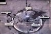
completed an in-depth assessment of the core area of the San Francisco Bay (3,800 square kilometres).
They claimed that the satellite also captured images of a broad region around a US city in just 42 seconds, which is reported to be a lot faster than many commercial satellites. The photographs were clear enough to identify a military vehicle on the street and determine what kind of weapon it was carrying, they stated as reported by
Sputnik citing the
South China Morning Post.
The photographs were reportedly taken from a height of 500 kilometres and had a resolution of 50 centimetres per pixel. The satellite's performance test found that it could capture images while spinning at up to 10 degrees per second, a speed never seen before on a satellite, according to the researchers. The research team also wrote an article about the satellite and its speed of capturing pictures, which was published in the Chinese journal Spacecraft Engineering earlier this month, as per
Sputnik. Yang Fang, a lead researcher, stated that China was a bit late in terms of agile satellite technology, but it made a lot of progress in a short amount of time.
Despite its small size and modest cost, Beijing-3 is considered the most agile satellite in terms of speed and could be one of the most powerful Earth observation satellites ever produced, according to the research. Because of the satellite's agility,
it was able to fulfil certain previously thought-to-be-impossible observation tasks. These include taking photos of the winding, 6,300-kilometre-long Yangtze River between the Tibetan plateau and the East China Sea in just one fly-by from north to south across China, the report stated.
Beijing-3's response time is 2-3 times faster than America's WorldView-4 satellite
The satellite, which is equipped with AI, is said to be able to choose its flight itinerary automatically, monitoring up to 500 places of interest across the world with around 100 revisits per day. The satellite can also detect the presence of specific targets and send photos of them to ground control. It is worth mentioning here that
Beijing-3's response time is 2-3 times faster than WorldView-4, one of the most advanced Earth observation satellites developed by the United States using similar technology, as per the report. Furthermore, the scanning band of Beijing-3 is 77% wider than WorldView-4's despite weighing half as much.


 No wonder. Seems like all the stolen data from cyberattack was used for practising algorithm.