check here .
Find local businesses, view maps and get driving directions in Google Maps.

www.google.com
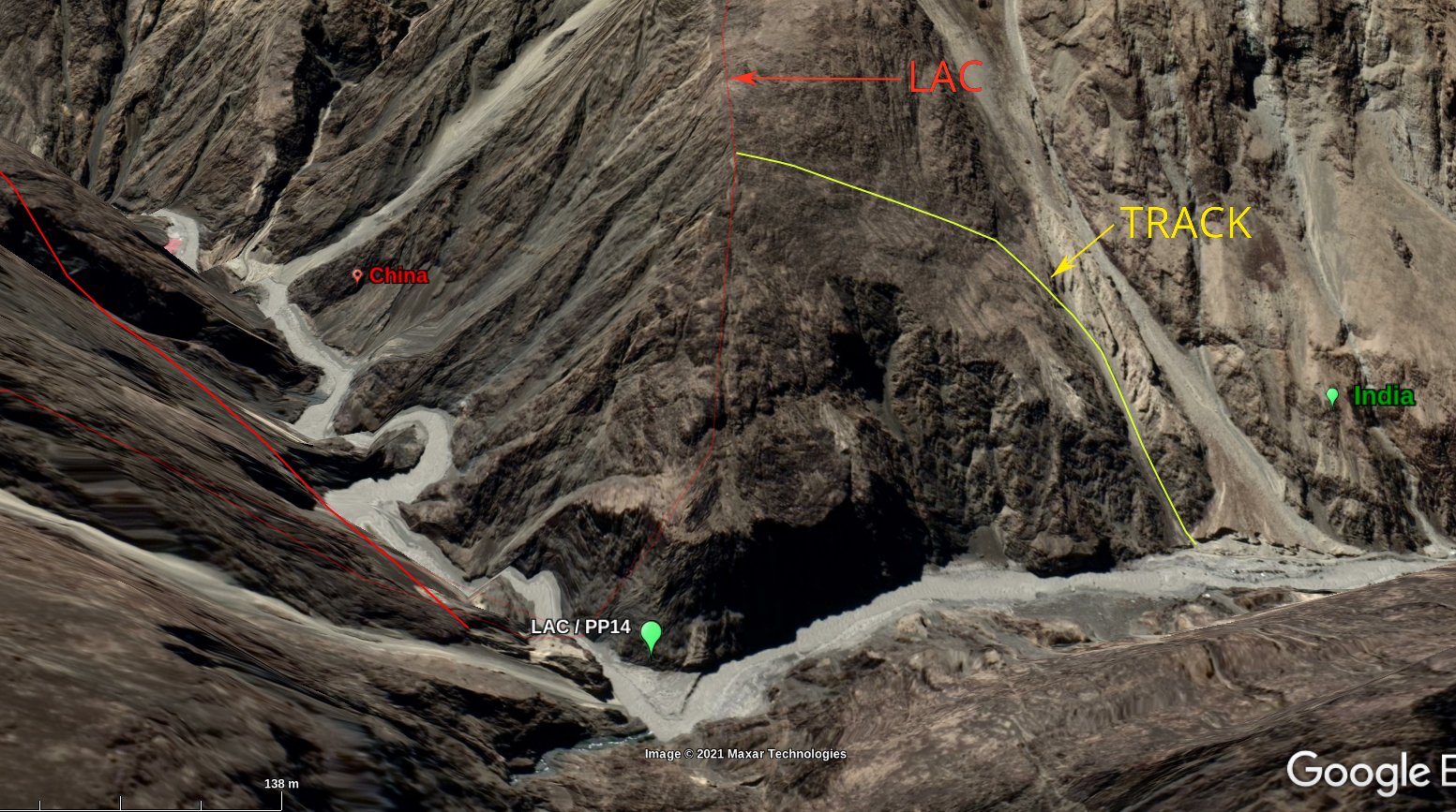
that building is PLA , opposite side of stream is our base
i think that stream going down is called Charding nala , trace down along the stream
left of stream is india , right china , you can see their dirt road plus some posts
see here
Find local businesses, view maps and get driving directions in Google Maps.
www.google.com
thats their post , on right side of stream , there is a round post , white tents.
i think somewhere here they crossed the stream leftward , and pitched tents on our land.

 who cares , whats point of wasting an hour to see some chini asshole tents