Automatic Kalashnikov
New Member
- Joined
- Aug 17, 2020
- Messages
- 5,672
- Likes
- 22,116
Really we lost land in disengagement ? As tweet claim
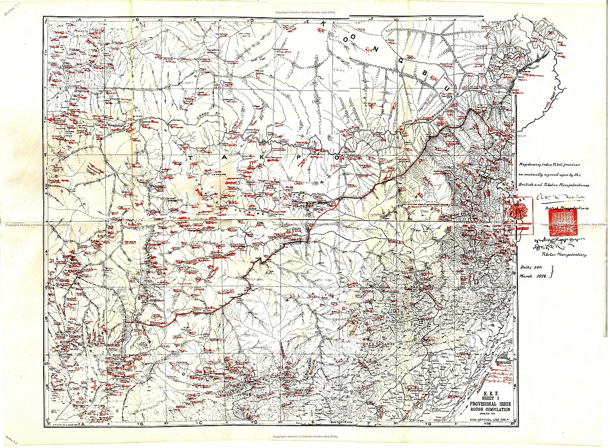
that line is not the LAC , thats the mcmahon line , maybe the british dude who drew border was high , but for some reason the border there is a straight horizontal line .If this Wikipedia article is correct - https://en.wikipedia.org/wiki/Sumdorong_Chu_standoff
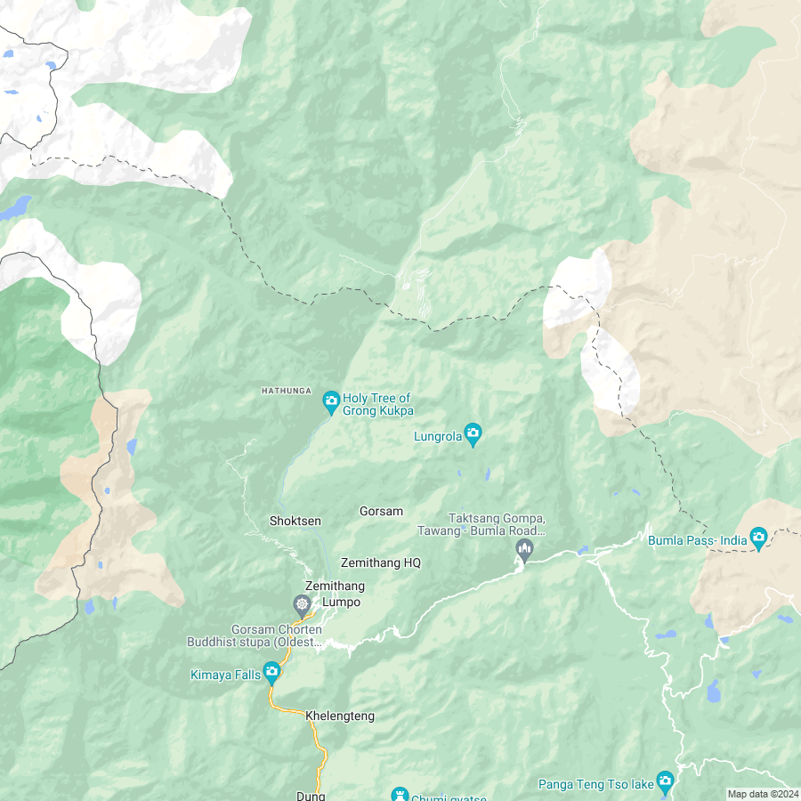
Then no area has been lost. Just verified with GE 2020 Nov/Dec imagery, in fact, we are aggressive and making roads inwards crossing the LAC
that line is not the LAC , thats the mcmahon line , maybe the british dude who drew border was high , but for some reason the border there is a straight horizontal line .
actual LAC is not shown on google maps or earth. its much north , but its still much less than our official border line there.
we did lose the sumdorong valley to chinese . but gained back the pasture area infront of it .
dont know if you can call it as a win or lose.
Show me? Or any Indian historical map showing our official boundary / LAC ?actual LAC is not shown on google maps or earth. its much north , but its still much less than our official border line there.
If the Wikipedia article is to be trusted, it says there was no compromise and things returned to normal.we did lose the sumdorong valley to chinese . but gained back the pasture area infront of it .
Really we lost land in disengagement ?
Guess the areas are now exclusively manned by the military, and is a no go area for civilians.. Army wouldn't want people snooping around...
like i said , the line is mcmahaon , but its not official border.Show me? Or any Indian historical map showing our official boundary / LAC ?
If the Wikipedia article is to be trusted, it says there was no compromise and things returned to normal.
But would like to know more about this case, please give me the source/maps from where you are getting the info.

 en.wikipedia.org
Ya'll Nibbiars this again shows Mokoman-CCP.like i said , the line is mcmahaon , but its not official border.
that sumdorong valley looks lost + pla post is inside our official border.

Google Maps
Find local businesses, view maps and get driving directions in Google Maps.www.google.com

McMahon Line - Wikipedia
en.wikipedia.org
Survey of India Maps
indiamaps.gov.in
Bille your execution has been ordered
Ya'll Nibbiars Mani mau.Bille your execution has been ordered

Good bye
PLA is not going to budge, it will need to give Indian army a crushing blow. Post which nobody will challenge its hegemony in Asia. Therefore, it will be able to give full attention to oust USA from number 1 spot.Pangong Lake today
Any idea which area he is referring to.
That i also asked !Any idea which area he is referring to.
Ig it is from thisAny idea which area he is referring to.

Another LOC in making.Ig it is from this

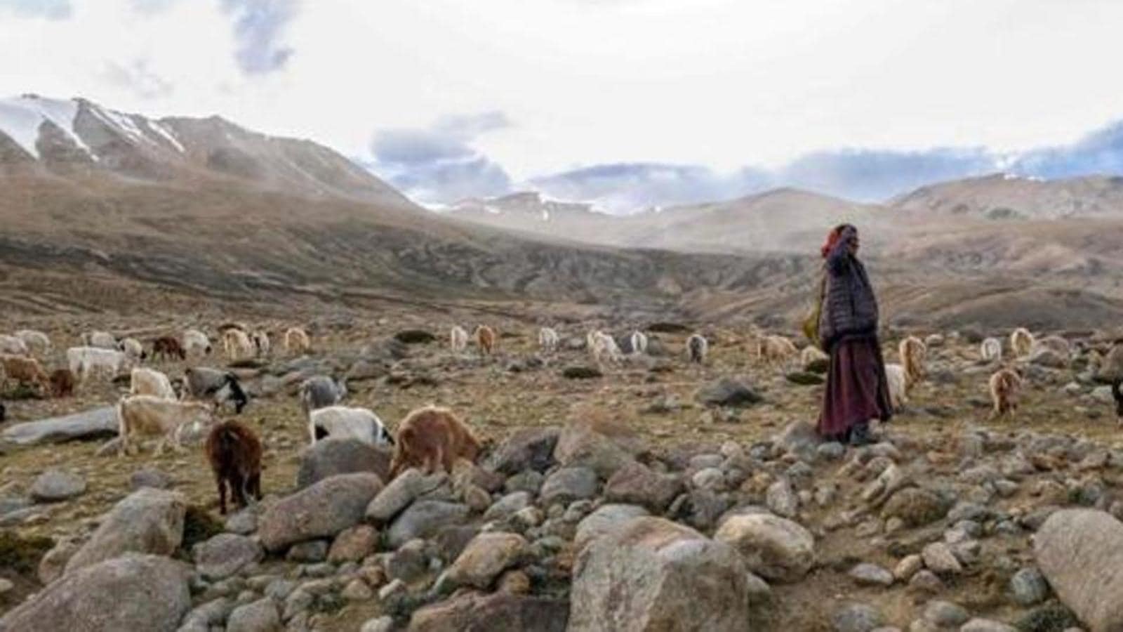
Ladakh Councillor says nomads had no access to grazing land
Speaking to HT from Ladakh on Tuesday, Stanzin said, after a long time nomads on their own initiative had decided to take their flock to grazing lands in Khu-la and other areas, but faced restrictions from the Indian sidewww.google.com
But I was more concerned about the safe shelters thing
| Thread starter | Similar threads | Forum | Replies | Date |
|---|---|---|---|---|
|
|
India-China 2020 Border Dispute - Military and Strategic Discussion | Indian Army | 19501 | |
| V | Non-Military implications of India-China Standoff 2020 | China | 61 | |
|
|
Memes & Jokes India China Standoff 2020 | Members Corner | 334 | |
|
|
India to overtake China in 2020: Swaminathan Aiyar | Economy & Infrastructure | 33 |
