OSINT from Satellite images

Tanmay

New Member
Joined
Dec 6, 2017
Messages
1,220
Likes
2,734
Country flag
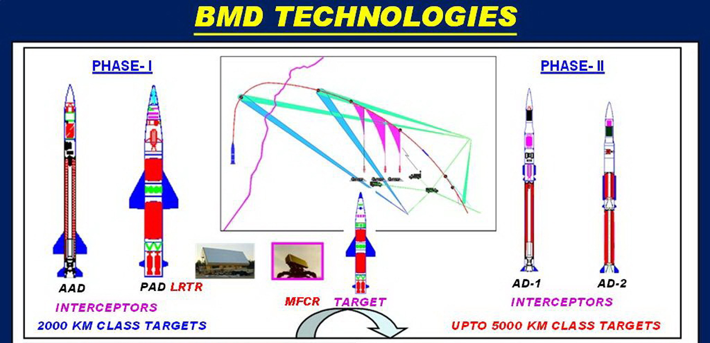
Better then posting pic and location, we should mark the locations of these TPS 77 radars, that will be good project to work here in our free time. Once marked we could see how much area they could see.
^^ kmz file with known TPS 77 radars in above link.
Clubbed info from BR too.
Paki Radars, Artillery along LOC, Air fields, Nuke sites
Chinese Radars, infra, Airfields
 

Tanmay

New Member
Joined
Dec 6, 2017
Messages
1,220
Likes
2,734
Country flag
24°39'18.37"N 68°51'47.47"E
Vehicle Mounted Radar on a ramp at Badin.
BAdin.JPG


New LY-80SAM?
Near Karachi International Airport
Appeared in 2018.

24°55'3.75"N 67°11'21.10"E

vehicles.JPG

On top left the two vehicles seem to be radars
radar1.JPG

Perhaps this?
rada3.jpg


This seems to be guidance radar in folded condition
radar2.JPG

This is guidance radar.

Guidance.jpg
 

delbruky

THE VALOR OF BHAI SATI DAS 1621-1675
New Member
Joined
Feb 16, 2017
Messages
328
Likes
665
Country flag
Here you go.

Not sure if our dumb and lethargic bharat sarkar is heading to these threats.
卫纳夜格@Raj‏@rajfortyseven
#China builds #satellite tracking& #calibration stations to blind,disable or destroy #India's satls moving over #Tibet. Similar to #Delijan stn points #Chinacould've illegally supplied tech to #Iranneeded to track #US satls. May soon dply #ASAT in Tibet


卫纳夜格@Raj‏@rajfortyseven Mar 7
If #India wants to be a power worth reckoning,it must stand on its own 2 feet especially in field of defence!Dependence on foreign power for defence rqmts will bring you to a grinding halt during crisis.We've every capability&resource.Only will to work hard needed to get results!

https://theprint.in/national-securi...ntre-tibet-track-blind-indian-eyes-sky/39543/
 

sayareakd

New Member
Joined
Feb 17, 2009
Messages
17,734
Likes
18,953
Country flag
Raj sir is our guiding light when it comes to satellites. I learn lot from him.
 

delbruky

THE VALOR OF BHAI SATI DAS 1621-1675
New Member
Joined
Feb 16, 2017
Messages
328
Likes
665
Country flag
Raj sir is our guiding light when it comes to satellites. I learn lot from him.
I hope our rakha mantri Smt. Niramala S ji is listening. There can't be anything worse for any national security establishment to be caught unaware dead in their tracks when the enemy attacks, for example kargil fiasco.
 

sayareakd

New Member
Joined
Feb 17, 2009
Messages
17,734
Likes
18,953
Country flag
I hope our rakha mantri Smt. Niramala S ji is listening. There can't be anything worse for any national security establishment to be caught unaware dead in their tracks when the enemy attacks, for example kargil fiasco.
Thanks; very few people like you and me; rest all including some phd. are blind followers; others too scared to speak, some just fooling people, some just have no idea, as if, all is well. Only now that they started singing differently.

Someone said to me, my post, i undermine state(govt); i think security of Country is above state. We are all on same side, but that does not mean that i will close my eyes and say this is not danger and become ostrich.

Any way back to topic at hand.
 

AMCA

New Member
Joined
May 19, 2017
Messages
2,562
Likes
17,850
Country flag
Here you go.

Not sure if our dumb and lethargic bharat sarkar is heading to these threats.
卫纳夜格@Raj‏@rajfortyseven
#China builds #satellite tracking& #calibration stations to blind,disable or destroy #India's satls moving over #Tibet. Similar to #Delijan stn points #Chinacould've illegally supplied tech to #Iranneeded to track #US satls. May soon dply #ASAT in Tibet


卫纳夜格@Raj‏@rajfortyseven Mar 7
If #India wants to be a power worth reckoning,it must stand on its own 2 feet especially in field of defence!Dependence on foreign power for defence rqmts will bring you to a grinding halt during crisis.We've every capability&resource.Only will to work hard needed to get results!

https://theprint.in/national-securi...ntre-tibet-track-blind-indian-eyes-sky/39543/
:facepalm::facepalm::facepalm:

Its not a satellite tracking or ASAT weapon station but a
Shiquanhe space observatory with
gravitational wave telescope located near Ngari (32°31'00.0"N 80°04'00.0"E).

And our media has already reported about its presence in 2017 itself.


China to set up world’s highest altitude telescopes in Tibet.

https://www.hindustantimes.com/worl...es-in-tibet/story-QJzNQihwqC7g80HajTsEyK.html


China to set up gravitational wave telescopes in Tibet

Construction has started for the first telescope, code-named Ngari No.1, 30 km south of Shiquanhe town in Ngari Prefecture.

Ngari, with its high altitude, clear sky, and minimal human activity, is said to be one of the world’s best spots to detect tiny twists in cosmic light.

Yao said the Ngari observatory will be among the world’s top primordial gravitational wave observation bases, alongside the South Pole Telescope and the facility in Chile’s Atacama Desert.


And is Mr. Raj talking about Shooting out satellites using ground based Laser???


Meanwhile here is a beautiful picture of ISRO's High Energy Gamma Ray Telescope (HAGAR), Hanle, Ladakh, India
 
Last edited:

Tanmay

New Member
Joined
Dec 6, 2017
Messages
1,220
Likes
2,734
Country flag
Btw just for info.
Karwar naval port has been updated on google earth. Not much work since last year. But yea you can see work in progress on right side of the port two new piers?
 

Tanmay

New Member
Joined
Dec 6, 2017
Messages
1,220
Likes
2,734
Country flag
NE....................................................................................................
Cool. Do tell if you spot any GS-100 LRTR :p Not a single photo available from IAF too
 

sayareakd

New Member
Joined
Feb 17, 2009
Messages
17,734
Likes
18,953
Country flag
Cool. Do tell if you spot any GS-100 LRTR :p Not a single photo available from IAF too


...................................................................................................................:bounce:
 

Tanmay

New Member
Joined
Dec 6, 2017
Messages
1,220
Likes
2,734
Country flag


...................................................................................................................:bounce:
Sorry I meant GS-100 LLTR low level transportable radar :p .
19 being delivered by Thales-BEL partnership. LRDE Ashwini LLTR equivalent .
 

AMCA

New Member
Joined
May 19, 2017
Messages
2,562
Likes
17,850
Country flag
There has been massive increase in IA presence in north Sikkim. New helipads and shelters for armoured vehicles are clearly visible on google earth. If IA moves eastwards from north Sikkim they can cut off chumbi valley from rest of China.
 
Last edited:

sayareakd

New Member
Joined
Feb 17, 2009
Messages
17,734
Likes
18,953
Country flag
There has been massive increase in IA presence in north Sikkim. New helipads and shelters for armoured vehicles are clearly visible on google earth. If IA moves eastwards from north Sikkim they can cut off chumbi valley from rest of China.
Thats in response from other side increase in presence and permanent structures.
 

AMCA

New Member
Joined
May 19, 2017
Messages
2,562
Likes
17,850
Country flag
Thats in response from other side increase in presence and permanent structures.
..................................................................................
 
Last edited:
Thread starter Similar threads Forum Replies Date
DFIlite DFIlite twitter OSINT post OSINT 22
Haldilal OSINT Images Contribution Members Corner 74
Haldilal DFI OSINT Images Contribution. OSINT 8
H OSINT compilation thread Knowledge Repository 54
Similar threads


Articles

Top