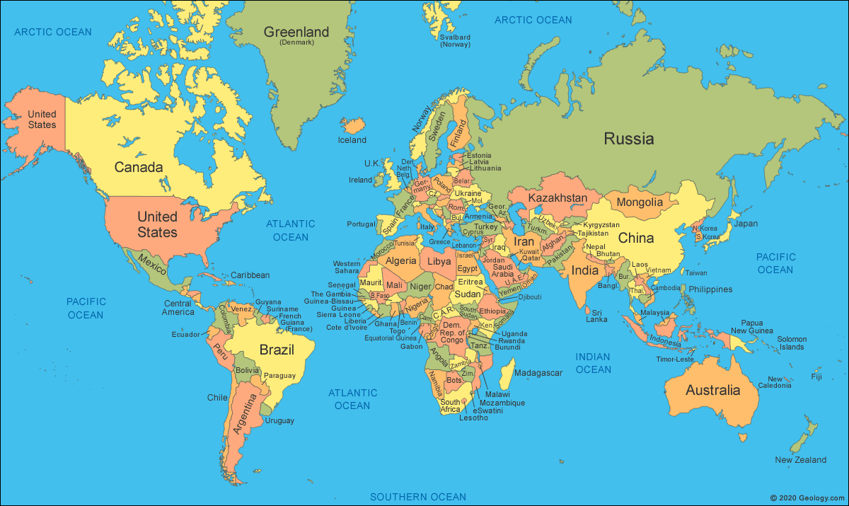
The mathematics of projection do not permit any particular map projection to be "best" for everything. Something will always get distorted. Therefore a diversity of projections exists to service the many uses of maps and their vast range of scales.
Modern national mapping systems typically employ a transverse Mercator or close variant for large-scale maps in order to preserve conformality and low variation in scale over small areas. For smaller-scale maps, such as those spanning continents or the entire world, many projections are in common use according to their fitness for the purpose.[1]
Thematic maps normally require an equal area projection so that phenomena per unit area are shown in correct proportion.[2] However, representing area ratios correctly necessarily distorts shapes more than many maps that are not equal-area. Hence reference maps of the world often appear on compromise projections instead. Due to the severe distortions inherent in any map of the world, within reason the choice of projection becomes largely one of æsthetics.
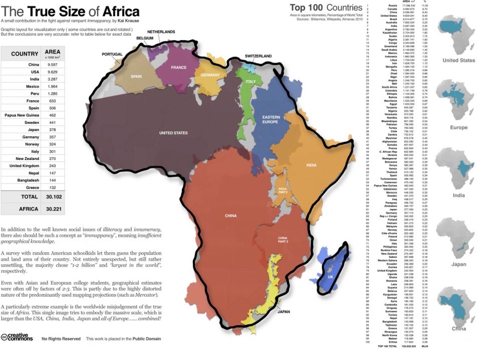
The Mercator projection, developed for navigational purposes, has often been used in world maps where other projections would have been more appropriate.[3][4][5][6] This problem has long been recognized even outside professional circles. For example a 1943 New York Times editorial states:
The time has come to discard [the Mercator] for something that represents the continents and directions less deceptively... Although its usage... has diminished... it is still highly popular as a wall map apparently in part because, as a rectangular map, it fills a rectangular wall space with more map, and clearly because its familiarity breeds more popularity.[7]
A controversy in the 1980s over the Peters map motivated the American Cartographic Association (now Cartography and Geographic Information Society) to produce a series of booklets (including Which Map is Best[8]) designed to educate the public about map projections and distortion in maps. In 1989 and 1990, after some internal debate, seven North American geographic organizations adopted a resolution recommending against using any rectangular projection (including Mercator and Gall–Peters) for reference maps of the world.[6][9]