- Joined
- May 26, 2010
- Messages
- 31,122
- Likes
- 41,042
'Pangong Tso' India`s Weak Frontier ..
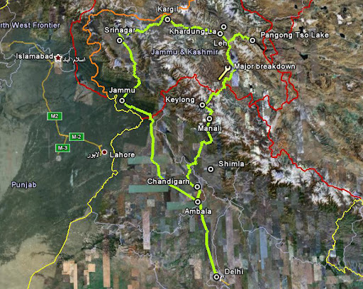


First glimpse of the incredibly blue Pangong Lake is a sight for sore eyes.Nestled between India and China at an altitude of 14,500 feet, the salt water lake with its various shades of blue is a photographer's delight. However, the deceptively calm Pangong Lake — or Lukung Lake as it is known among locals — is also one of the key border flashpoints between India and China that is waiting to explode. The area under contention is a 5-km stretch along the lake that both sides lay claim to.
There is buzz about a new Mechanized Infantry battalion coming up in the huge and the Indian Army's most important operational Command, the Udhampur-based Northern Command, and also a makeshift new airstrip in Mud village at the Sino-Indian border, near Pangong.Increasing activities of China, at the border, has forced New Delhi to sit up and take notice and come up with measures.
Chumur, near Thankung post, where the airspace violation took place on June 21 this year, is 60-70 kilometers from the Line of Actual Control (LAC), near Pangong-tso, the world's most beautiful lake. The lake spreading 135 kilometers in length and about five kilometers in breadth and 210 meters in depth in right at the border, The Garrison battalion of the Indian Army posted there. On the lake itself, 45 km of which is in India while the remaining 90 km lies in China, both sides carry out regular patrols. While the standard drill when two boats from opposite sides come face to face is holding up flags saying "Hindi-Chini bhai bhai" by soldiers from both countries, the subdued aggression sometimes surfaces.


Close to two months ago, an Indian motorboat on regular patrolling duty along the perceived border in the lake, was surrounded by three Chinese naval crafts. Things started turning tense as the Chinese crafts approached the Indian boat (which was sufficiently armed with two machine guns and a 20 -member contingent). The situation calmed down only after the quick thinking operator swung around the larger Indian boat in circles to disperse the Chinese crafts.
While such incidents of aggression are rare, Indian soldiers have to remain on their toes. Especially as China has a stronger military presence on the lake. The Chinese Navy operates close to 22 armed patrol boats in the lake — mostly smaller vessels seating five to seven soldiers.
India, on the other hand, has two patrol boats that are operated by the Army. While these boats are bigger — carrying up to 21 soldiers — the numeric superiority that China enjoys is undeniable. Stuck in the corridors of South Block is a proposal to ferry in an additional 10-12 boats for better patrolling of the lake. Last month's visit to Pangong Lake by Navy chief Admiral Sureesh Mehta is expected to give an impetus to the proposal.
Chinese airforce helicopter violated Indian air space, to which an army officer added that its a common phenomenon in that area, and it often happens.
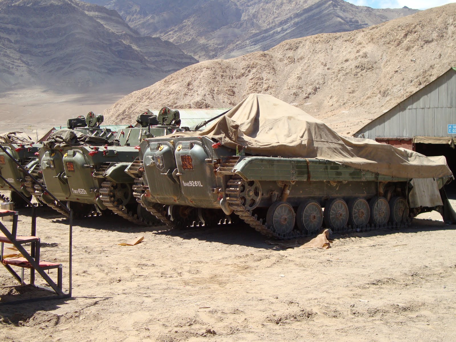
The lone mechanised infantry battalion, presently 1 Guards, posted in Karu has 52 ICVs , which can be air lifted in IL-76 aircraft of the Indian Air Force (IAF) as well as can be moved on land at the height of 11,800 feet, have been deployed for defensive purposes and mainly safeguarding the region. Said an officer
An senior officer told People's Post, "These violations, airspace as well as sometimes on land, take place at the LAC, as it is not recognised by the Chinese. They refuse to take any recognition of the maps offered by India in the late 90s and mid-2000s. Whenever a map was offered by the Indian side it was rejected by Beijing, and LAC is still disputed, which is why it is always violated."
Ministry of Defence figures say that there were 233 violations in 2008 and more than 75 in the past three months. The violation has been taken up with Beijing, but there has been no statement from the Chinese embassy in New Delhi.
The Actual Ground Position Line (AGPL) is 982 kilometers, falling between Indiracol (the northern-most tip of India) and K2 and LAC begins after that between K2 and Arunachal Pradesh measuring around 3800 kilometers.
First glimpse of the incredibly blue Pangong Lake is a sight for sore eyes.Nestled between India and China at an altitude of 14,500 feet, the salt water lake with its various shades of blue is a photographer's delight. However, the deceptively calm Pangong Lake — or Lukung Lake as it is known among locals — is also one of the key border flashpoints between India and China that is waiting to explode. The area under contention is a 5-km stretch along the lake that both sides lay claim to.
There is buzz about a new Mechanized Infantry battalion coming up in the huge and the Indian Army's most important operational Command, the Udhampur-based Northern Command, and also a makeshift new airstrip in Mud village at the Sino-Indian border, near Pangong.Increasing activities of China, at the border, has forced New Delhi to sit up and take notice and come up with measures.
Chumur, near Thankung post, where the airspace violation took place on June 21 this year, is 60-70 kilometers from the Line of Actual Control (LAC), near Pangong-tso, the world's most beautiful lake. The lake spreading 135 kilometers in length and about five kilometers in breadth and 210 meters in depth in right at the border, The Garrison battalion of the Indian Army posted there. On the lake itself, 45 km of which is in India while the remaining 90 km lies in China, both sides carry out regular patrols. While the standard drill when two boats from opposite sides come face to face is holding up flags saying "Hindi-Chini bhai bhai" by soldiers from both countries, the subdued aggression sometimes surfaces.
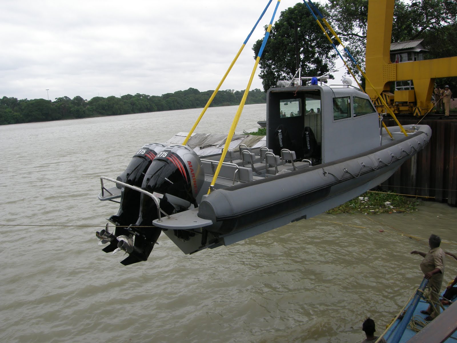
China Border Guard Armed Armored Hi-Speed Patrol Boats, 50cal machine gun effective range 2000ms..
Close to two months ago, an Indian motorboat on regular patrolling duty along the perceived border in the lake, was surrounded by three Chinese naval crafts. Things started turning tense as the Chinese crafts approached the Indian boat (which was sufficiently armed with two machine guns and a 20 -member contingent). The situation calmed down only after the quick thinking operator swung around the larger Indian boat in circles to disperse the Chinese crafts.
While such incidents of aggression are rare, Indian soldiers have to remain on their toes. Especially as China has a stronger military presence on the lake. The Chinese Navy operates close to 22 armed patrol boats in the lake — mostly smaller vessels seating five to seven soldiers.
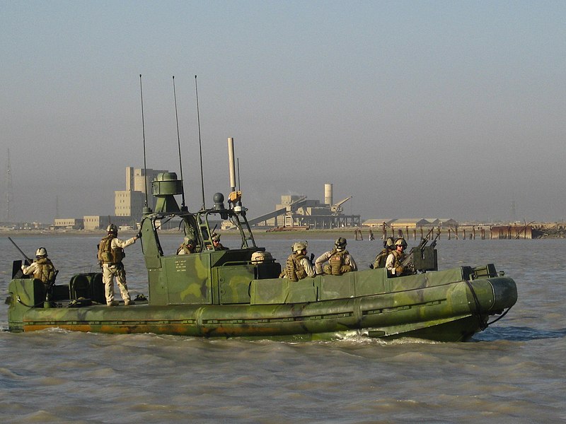
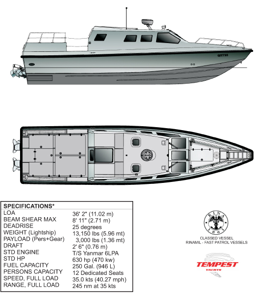
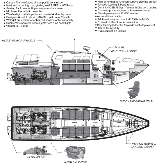
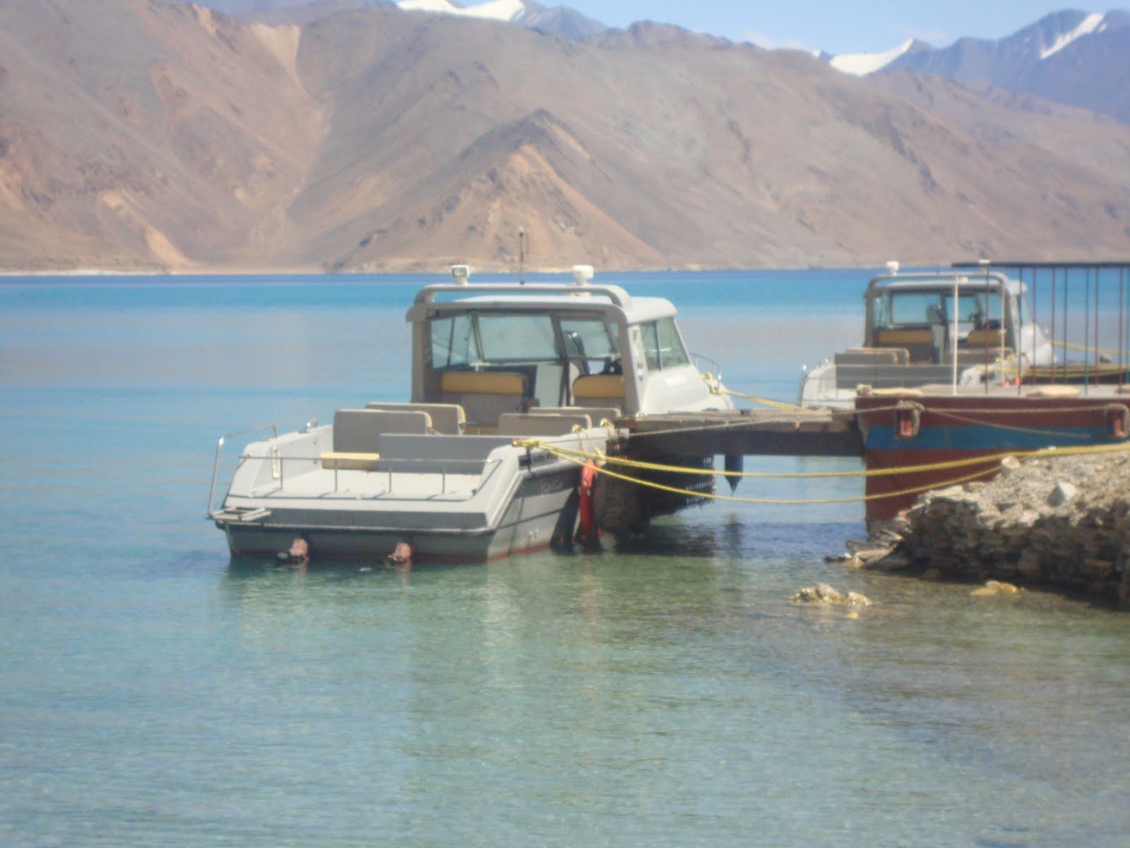
Unarmed Unarmored Indian Army Boats..
India, on the other hand, has two patrol boats that are operated by the Army. While these boats are bigger — carrying up to 21 soldiers — the numeric superiority that China enjoys is undeniable. Stuck in the corridors of South Block is a proposal to ferry in an additional 10-12 boats for better patrolling of the lake. Last month's visit to Pangong Lake by Navy chief Admiral Sureesh Mehta is expected to give an impetus to the proposal.
Chinese airforce helicopter violated Indian air space, to which an army officer added that its a common phenomenon in that area, and it often happens.
The lone mechanised infantry battalion, presently 1 Guards, posted in Karu has 52 ICVs , which can be air lifted in IL-76 aircraft of the Indian Air Force (IAF) as well as can be moved on land at the height of 11,800 feet, have been deployed for defensive purposes and mainly safeguarding the region. Said an officer
An senior officer told People's Post, "These violations, airspace as well as sometimes on land, take place at the LAC, as it is not recognised by the Chinese. They refuse to take any recognition of the maps offered by India in the late 90s and mid-2000s. Whenever a map was offered by the Indian side it was rejected by Beijing, and LAC is still disputed, which is why it is always violated."
Ministry of Defence figures say that there were 233 violations in 2008 and more than 75 in the past three months. The violation has been taken up with Beijing, but there has been no statement from the Chinese embassy in New Delhi.
The Actual Ground Position Line (AGPL) is 982 kilometers, falling between Indiracol (the northern-most tip of India) and K2 and LAC begins after that between K2 and Arunachal Pradesh measuring around 3800 kilometers.
")