
Aestas Vivax
Regular Member
- Joined
- Aug 17, 2023
- Messages
- 33
- Likes
- 25
New thread, my very first thread. (Yipppe!)
The main goal of this thread is to document Air Defense (SAM systems) and maybe Radar systems of the Chinese forces. We also would be helping JJ in his work, as we can use our collective knowledge to Identify the Chinese Threat.
My posts would mainly be from the information from Jaidev Jamwal (Give him money), as I am not the smartest one, and he is one of the best OSINT / IMINT people from India on Twitter that I know.
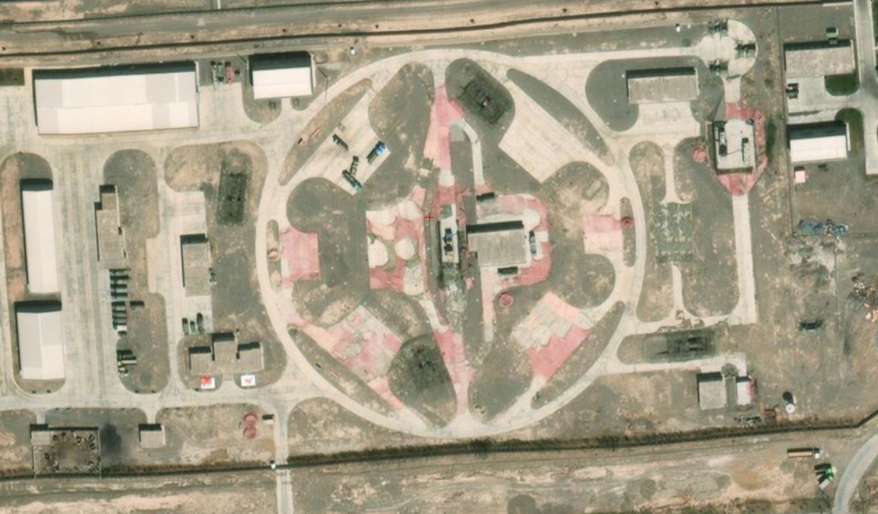
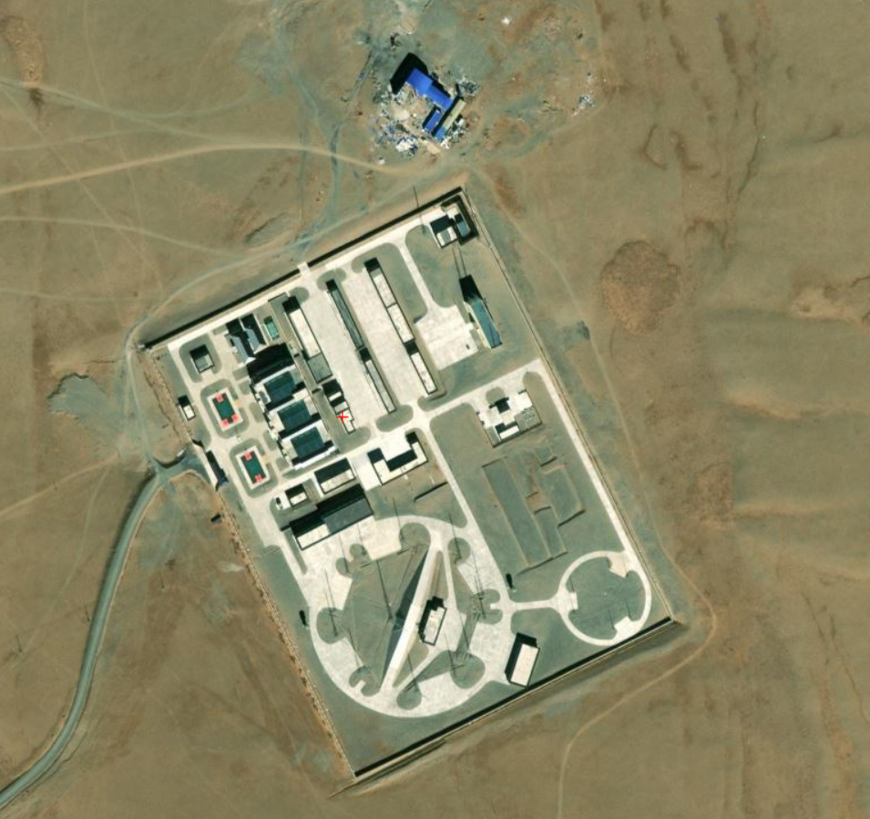
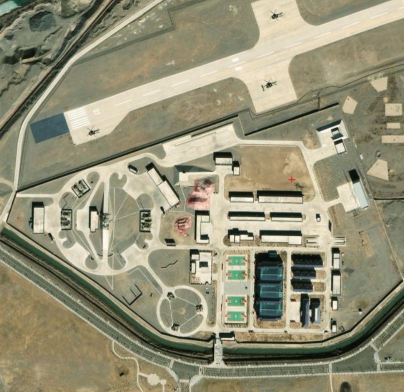
Starting from Kashgarh;
39°32'15"N 76°02'22"E - 39.53727814 , HQ-9 Site. Visible (S-300 Style) SAM Launchers and Radar (HT-233 engagement radar?)
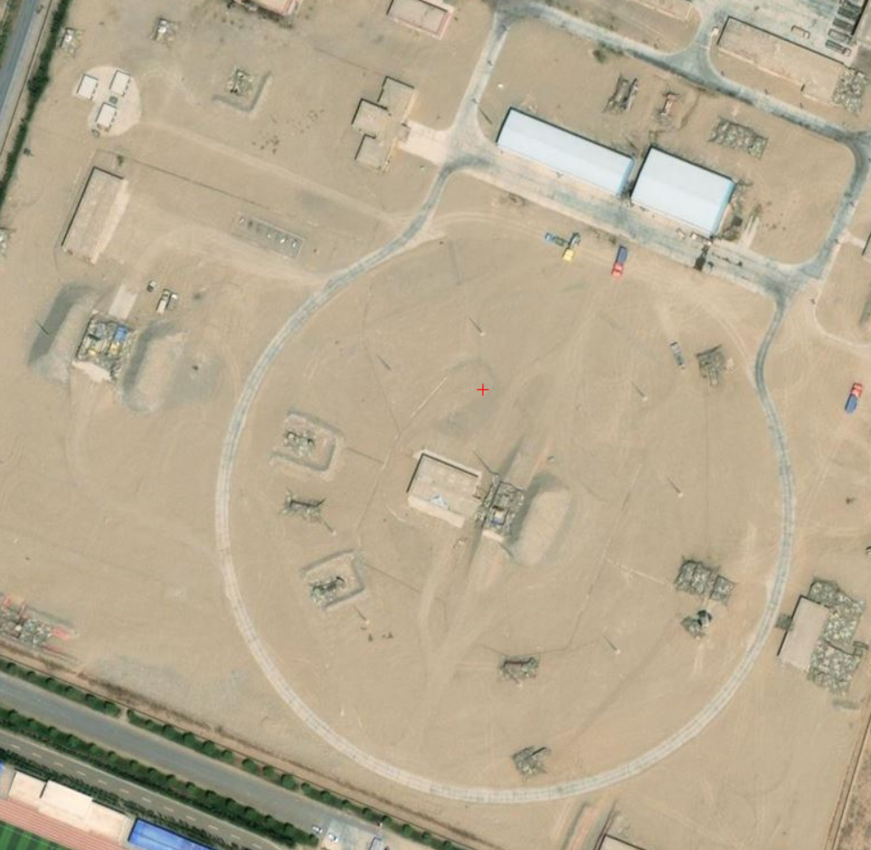
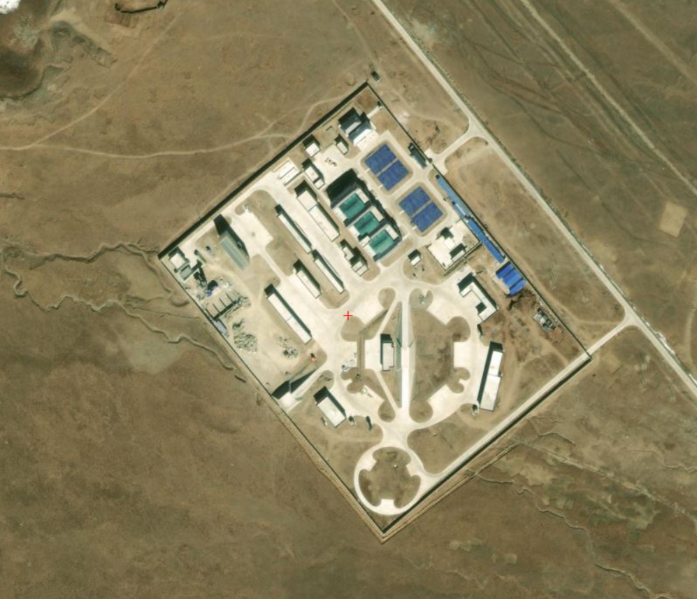
Hotan;
36°59'57"N 79°55'34"E - 36.9997159, 79.92637081. HQ-9 Site. (Visible S-300 Style Launcher, alot of camo nets used)
Pangong Tso (East);
33°33'05"N 79°55'56"E - Inactive. (HQ-9 pattern) - Some base nearby, so there is some logistic support if ever reactivated.
Gar County:
32°30'17"N 80°01'39"E - 32.50079065, 80.03137701- Inactive, Same story as the previous one.
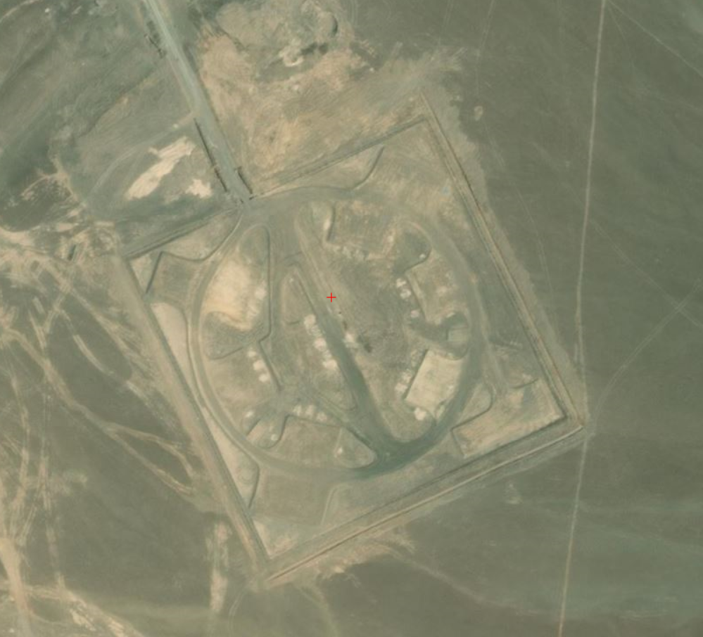
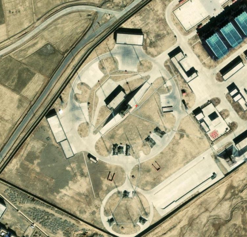
Maan sarovar:
30°46'51"N 81°37'09"E - 30.78107925, 81.61941289 - Said to be Inactive, Facilities look like it is active for S-300 Style SAMs
Pagri, Tibet:
27°44'17"N 89°08'23"E - 27.73804816, 89.13981256 - Similar looking S-300 Style SAM site
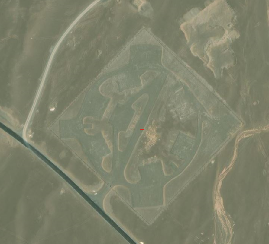
Qiaga:
28°53'41"N 89°31'23"E - 28.89528442, 89.52463444 - Similar design, but unable to recognize the systems present.
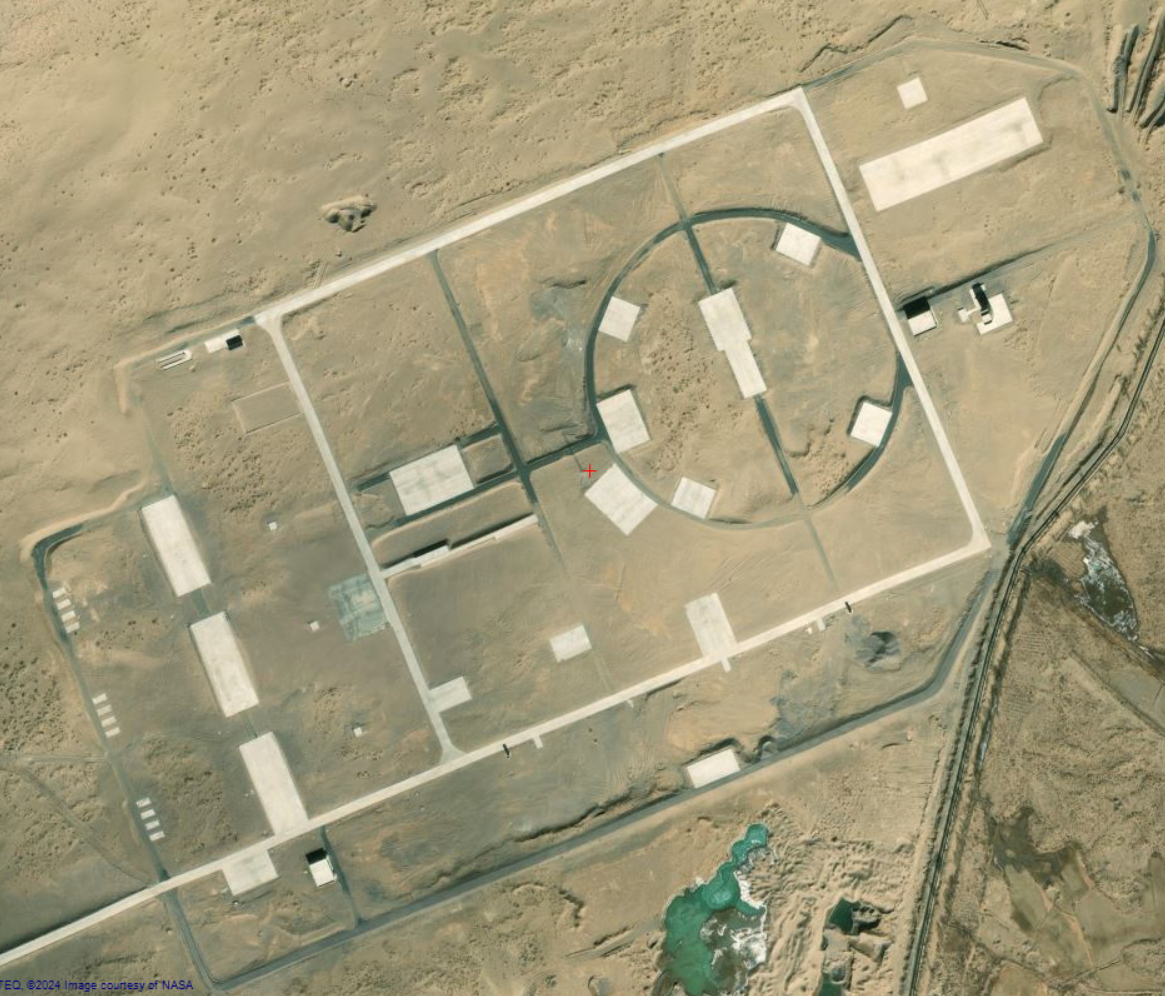
Xigaze:
29°20'03"N 89°19'39"E - 29.33437705, 89.32775467 - Underconstuction? Different SAM system? Not similar to previous designs.
Xigaze #2:
29°20'40"N 89°16'02"E - Looks like another S-300 Style SAM site
To be continued, courtesy JJ (Check his twitter)
To verify:
The main goal of this thread is to document Air Defense (SAM systems) and maybe Radar systems of the Chinese forces. We also would be helping JJ in his work, as we can use our collective knowledge to Identify the Chinese Threat.
My posts would mainly be from the information from Jaidev Jamwal (Give him money), as I am not the smartest one, and he is one of the best OSINT / IMINT people from India on Twitter that I know.
Starting from Kashgarh;
39°32'15"N 76°02'22"E - 39.53727814 , HQ-9 Site. Visible (S-300 Style) SAM Launchers and Radar (HT-233 engagement radar?)
Hotan;
36°59'57"N 79°55'34"E - 36.9997159, 79.92637081. HQ-9 Site. (Visible S-300 Style Launcher, alot of camo nets used)
Pangong Tso (East);
33°33'05"N 79°55'56"E - Inactive. (HQ-9 pattern) - Some base nearby, so there is some logistic support if ever reactivated.
Gar County:
32°30'17"N 80°01'39"E - 32.50079065, 80.03137701- Inactive, Same story as the previous one.
Maan sarovar:
30°46'51"N 81°37'09"E - 30.78107925, 81.61941289 - Said to be Inactive, Facilities look like it is active for S-300 Style SAMs
Pagri, Tibet:
27°44'17"N 89°08'23"E - 27.73804816, 89.13981256 - Similar looking S-300 Style SAM site
Qiaga:
28°53'41"N 89°31'23"E - 28.89528442, 89.52463444 - Similar design, but unable to recognize the systems present.
Xigaze:
29°20'03"N 89°19'39"E - 29.33437705, 89.32775467 - Underconstuction? Different SAM system? Not similar to previous designs.
Xigaze #2:
29°20'40"N 89°16'02"E - Looks like another S-300 Style SAM site
To be continued, courtesy JJ (Check his twitter)
To verify: