Why did China withdraw from Arunachal in 1962 skirmish?

roma

NRI in Europe
Senior Member
Joined
Aug 10, 2009
Messages
3,582
Likes
2,538
Country flag
entirely echo @Bhadra 's point i.e. no substantial alteration of actual control. nevertheless there was always a silver lining to the cloud
1) an end of further aggression by India, followed by decades of "peace and tranquility"
Indian aggression ??? - ABSOLUTE NONSENSE ! Between the two the, agressive ( or more accurately, the
AVARICIOUS ) one by far is you know who - and the ASEAN countries and Japan
are going to be telling the whole world ,
via the International Court of Justice all about that for the next few decades
- so the whole world will be reminded about the nature of your society.


2) earning an all weather friend. quite a twist for Pakistan from a member of encroaching SEATO to China's buddy.
so you have chosen packland as your toilet cleaners ? hahahahha :rofl::toilet:..... we, in comparison will have Japan :namaste: and Vietnam :thumb: as our respected associates - it's a good deal ! :lol:
 
Last edited by a moderator:

ITBP

Regular Member
Joined
May 14, 2014
Messages
338
Likes
137
India's claim on Aksai China and Arnunachal cant be be justified, those areas were never India's. And also certainly not China's either.

British Government of India pushed primitive Tibet to sign those after British expedition to Tibet. And then China was semi-modern country trapped by imperialists from all sides. China did not accept McMahon agreement in 1914, Chinese representatives walked away from meeting, within few weeks WW1 started, and the case was ignored. India retained those areas after British left, then China, too, now a Communist country claimed those.

We Indians should have sent our army in 1950 to Tibet. Then these problems would not arrive at all if Tibet was independent.
 

Bhadra

Professional
Joined
Jul 11, 2011
Messages
11,991
Likes
23,758
Country flag
India's claim on Aksai China and Arnunachal cant be be justified, those areas were never India's. And also certainly not China's either.

British Government of India pushed primitive Tibet to sign those after British expedition to Tibet. And then China was semi-modern country trapped by imperialists from all sides. China did not accept McMahon agreement in 1914, Chinese representatives walked away from meeting, within few weeks WW1 started, and the case was ignored. India retained those areas after British left, then China, too, now a Communist country claimed those.

We Indians should have sent our army in 1950 to Tibet. Then these problems would not arrive at all if Tibet was independent.


Aryavarta was not gifted to my ancestors by the likes of @ITBP ...... Ha Ha Ha ....

Aryavarta was a namea given to their homeland by ancient Aryans and Rishies.

Āryāvarta[pronunciation?] (Sanskrit: आर्यावर्त, "abode of the Aryans") is a name for North India in classical Sanskrit literature.[1] The Manu Smriti (2.22) gives the name to "the tract between the Himalaya and the Vindhya ranges, from the eastern(Bay of Bengal) to the Western Sea(Arabian Sea)".

The Vasistha Dharma Sutra I.8-9 and 12-13 locates Āryāvarta to the east of the disappearance of the Sarasvati in the desert, to the west of Kalakavana, to the north of the mountains of Pariyatra and Vindhya and to the south of the Himalaya. Baudhayana Dharmasutra (BDS) 1.1.2.10 gives similar definitions and declares that Āryāvarta is the land that lies west of Kalakavana, east of Adarsana, south of the Himalayas and north of the Vindhyas, but in BDS 1.1.2.11 Āryāvarta is confined to the Ganges - Yamuna doab, and BDS 1.1.2.13-15. Patañjali's Mahābhāṣya[citation needed] defines Āryāvarta like the Vasistha Dharma Sutra.

Āryāvarta - Wikipedia, the free encyclopedia

This included todays Ladakh and Arunachal Pradesh ...


Last edited by a moderator:

roma

NRI in Europe
Senior Member
Joined
Aug 10, 2009
Messages
3,582
Likes
2,538
Country flag
Aryavarta was not gifted to my ancestors by the likes of @ITBP ...... Ha Ha Ha ....

Aryavarta was a namea given to their homeland by ancient Aryans and Rishies.

Āryāvarta[pronunciation?] (Sanskrit: आर्यावर्त, "abode of the Aryans") is a name for North India in classical Sanskrit literature.[1] The Manu Smriti (2.22) gives the name to "the tract between the Himalaya and the Vindhya ranges, from the eastern(Bay of Bengal) to the Western Sea(Arabian Sea)".

The Vasistha Dharma Sutra I.8-9 and 12-13 locates Āryāvarta to the east of the disappearance of the Sarasvati in the desert, to the west of Kalakavana, to the north of the mountains of Pariyatra and Vindhya and to the south of the Himalaya. Baudhayana Dharmasutra (BDS) 1.1.2.10 gives similar definitions and declares that Āryāvarta is the land that lies west of Kalakavana, east of Adarsana, south of the Himalayas and north of the Vindhyas, but in BDS 1.1.2.11 Āryāvarta is confined to the Ganges - Yamuna doab, and BDS 1.1.2.13-15. Patañjali's Mahābhāṣya[citation needed] defines Āryāvarta like the Vasistha Dharma Sutra.

Āryāvarta - Wikipedia, the free encyclopedia

This included todays Ladakh and Arunachal Pradesh ...


Great post
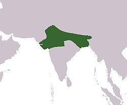
Please help by interpreting those scriptures you quoted into red boundary lines drown into the map ?
That would be very helpful to a lot of us to clearly define the extent of the nation from those scriptures.
 
Last edited by a moderator:

CCP

Senior Member
Joined
Jan 19, 2014
Messages
1,204
Likes
196
Aryavarta was not gifted to my ancestors by the likes of @ITBP ...... Ha Ha Ha ....

Aryavarta was a namea given to their homeland by ancient Aryans and Rishies.

Āryāvarta[pronunciation?] (Sanskrit: आर्यावर्त, "abode of the Aryans") is a name for North India in classical Sanskrit literature.[1] The Manu Smriti (2.22) gives the name to "the tract between the Himalaya and the Vindhya ranges, from the eastern(Bay of Bengal) to the Western Sea(Arabian Sea)".

The Vasistha Dharma Sutra I.8-9 and 12-13 locates Āryāvarta to the east of the disappearance of the Sarasvati in the desert, to the west of Kalakavana, to the north of the mountains of Pariyatra and Vindhya and to the south of the Himalaya. Baudhayana Dharmasutra (BDS) 1.1.2.10 gives similar definitions and declares that Āryāvarta is the land that lies west of Kalakavana, east of Adarsana, south of the Himalayas and north of the Vindhyas, but in BDS 1.1.2.11 Āryāvarta is confined to the Ganges - Yamuna doab, and BDS 1.1.2.13-15. Patañjali's Mahābhāṣya[citation needed] defines Āryāvarta like the Vasistha Dharma Sutra.

Āryāvarta - Wikipedia, the free encyclopedia

This included todays Ladakh and Arunachal Pradesh ...
Wang Xuance - Wikipedia, the free encyclopedia

Wang Xuance
(Chinese: 王玄策 (pinyin wáng xuáncè), fl. 7th century) was a Tang Dynasty guard officer and diplomat. In 648, Tang Taizong sent him to India in response to Harshavardhana sending an ambassador to China. However once in India he discovered Harshavardhana had died and the new king attacked Wang and his 30 mounted subordinates.[1] This led to Wang Xuance escaping to Tibet and then mounting a joint of over 7,000 Nepalese mounted infantry and 1,200 Tibetan infantry and attack on the Indian state on June 16. The success of this attack won Xuance the prestigious title of the "Grand Master for the Closing Court."[2] He also secured a reported Buddhist relic for China.[3]

Harsha - Wikipedia, the free encyclopedia


Arunasva the King of Harshabysumchung have been capture alive and sent back to Chinese capital and killed for his crime.
 
Last edited by a moderator:

Kunal Biswas

Member of the Year 2011
Ambassador
Joined
May 26, 2010
Messages
31,122
Likes
41,042
I am waiting for @Bhadra response for CCP reply ..

================

If what told by CCP is true, India then have more reasons to call tibet its own ..
 
Last edited by a moderator:

abhi_the _gr8_maratha

Senior Member
Joined
Apr 15, 2014
Messages
2,193
Likes
609
Country flag
and as cheap chinese products will be banned cause west and all want to sell its own
 
Last edited by a moderator:

Bhadra

Professional
Joined
Jul 11, 2011
Messages
11,991
Likes
23,758
Country flag
Wang Xuance - Wikipedia, the free encyclopedia

Wang Xuance
(Chinese: 王玄策 (pinyin wáng xuáncè), fl. 7th century) was a Tang Dynasty guard officer and diplomat. In 648, Tang Taizong sent him to India in response to Harshavardhana sending an ambassador to China. However once in India he discovered Harshavardhana had died and the new king attacked Wang and his 30 mounted subordinates.[1] This led to Wang Xuance escaping to Tibet and then mounting a joint of over 7,000 Nepalese mounted infantry and 1,200 Tibetan infantry and attack on the Indian state on June 16. The success of this attack won Xuance the prestigious title of the "Grand Master for the Closing Court."[2] He also secured a reported Buddhist relic for China.[3]

Harsha - Wikipedia, the free encyclopedia


Arunasva the King of Harshabysumchung have been capture alive and sent back to Chinese capital and killed for his crime.
Chinese did cross Himalayas but as our guests and Friends. In ancient times, India's gateway to China was essentially through Afghanistan and East Turkmenistan and less via Tibet.

Tibet was always Indian alley with almost no problems of delineation of border between the two sides.

Himalaya and high trans Himalayans mountaians were always accepted bounderies between the two civilisations.

And that is what Indian stand is .

Suddenly China comes into picture post 1949 and says - Look Nehru that is the boundry !

How can India accept that !

Chinese hegemony, Maoist dictatorship, unilateral behaviour, military aggression, and dictating terms to India is the main cause of the problem between India and China and not boundary here or there .
 

Bhadra

Professional
Joined
Jul 11, 2011
Messages
11,991
Likes
23,758
Country flag
Great post
Please help by interpreting those scriptures you quoted into red boundary lines drown into the map ?
That would be very helpful to a lot of us to clearly define the extent of the nation from those scriptures.
In those ancient days, areas were defined as regions by name and boundaries of Aryavarta have been described from West to East and North to south in terms of Prominent features such as Himalayas or sea coasts.

In during that time in spite of various separate states existing, a vast geographical area was described as a nation - a Cultural nation.
 

Latest Replies

Global Defence

New threads

Articles

Top