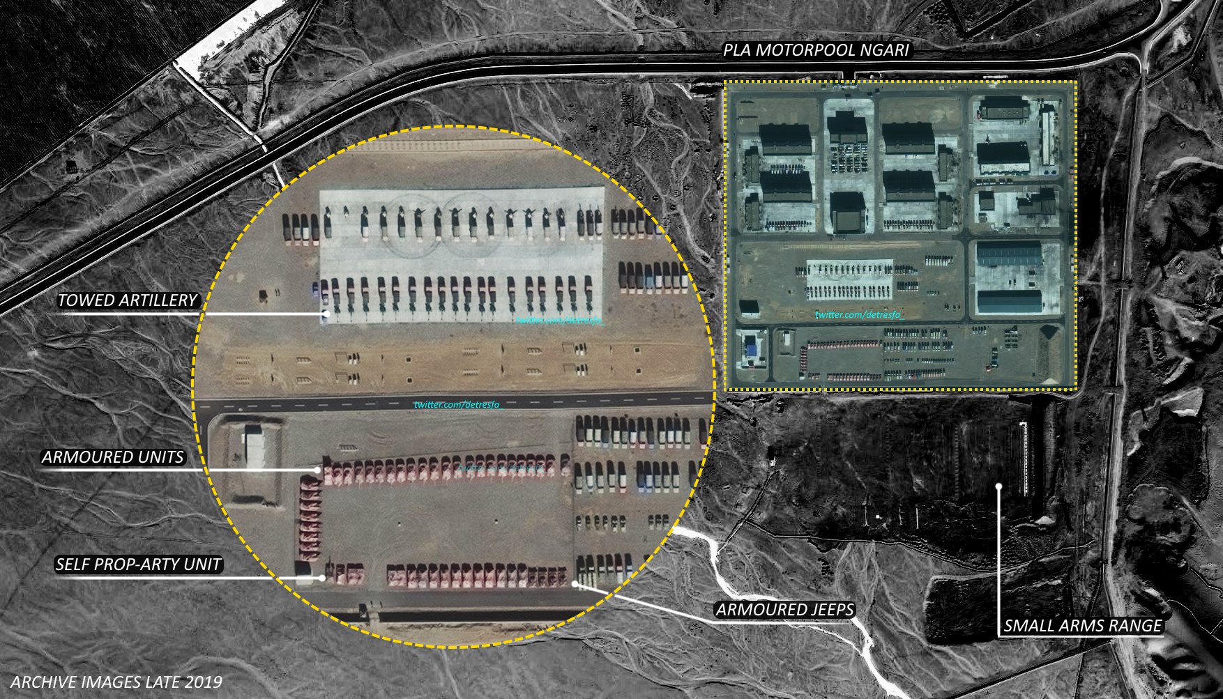
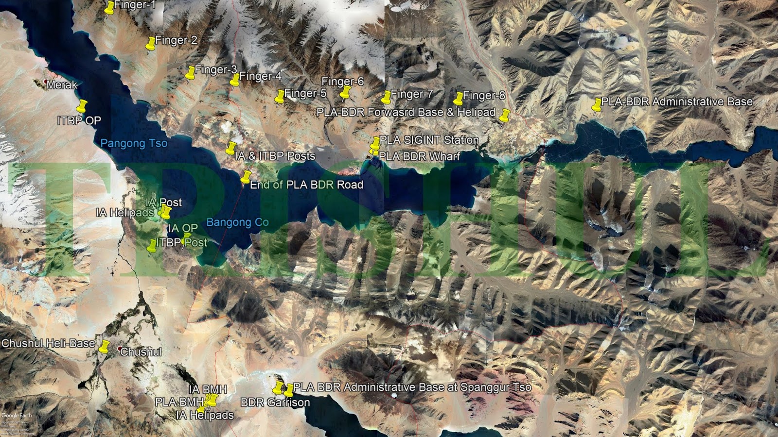
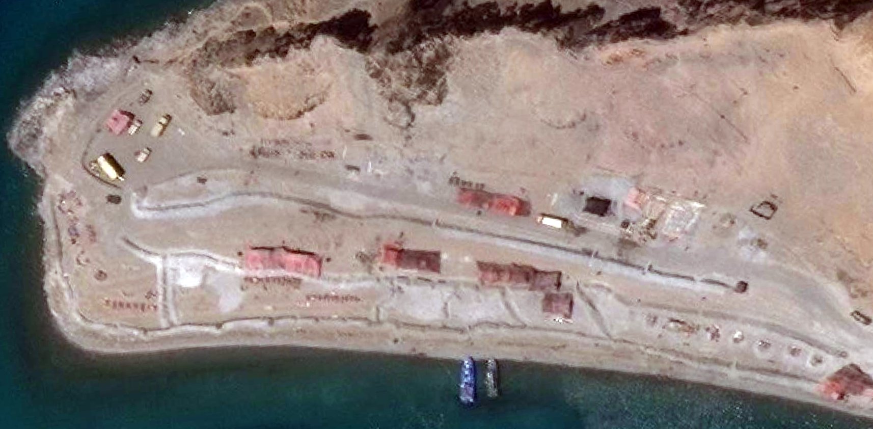
Doesn't matter finger 4 or 5. In the above picture, India has permanent presence till just before finger 4 ("India Base"), and China apparently has built permanent roads right under the nose of this India Base -a) without India knowing about this dangerous activity, or b) accepting that China has now occupied areas upto Finger 4, and India can do nothing about it.2004 : you can see the Chinese black topped road and big circle to turn a round
View attachment 49197
2019: Same road. Black topped with circle. No change
View attachment 49196
As seen India doesnt have a road till this location. So we are on foot.
Now theres an issue what "finger" is this.
Most called it finger 4 on twitter and other forums
2) Iyer and Destresfa calls it finger 4
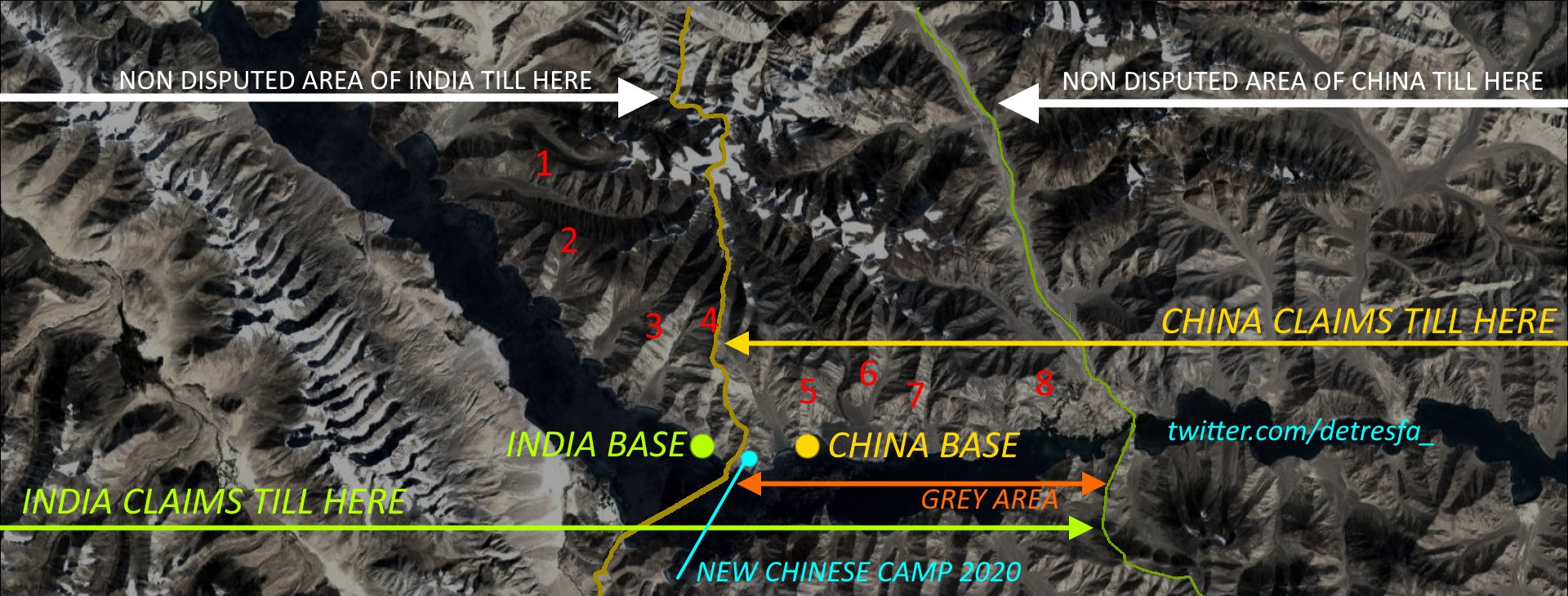
If China has built blacktopped roads in finger 4, I would imagine they would have built roads all the way from finger 8 to finger 4! In effect, all these areas have been ceded by India to China all these years. China would definitely have fortified all these areas, and will not allow even a crow to enter these very sensitive areas, let alone IA patrols!
Under this scenario, to say IA is sending patrols all the way upto finger 8 seems incredulous- they are crossing over the chinese areas/roads in finger 4? Under the nose of chinese?
Chinese behavior in SCS is so drastically different- they will chase away/sink any boats that they think are in their area of control, rapidly build artificial islands/airstrips to tighten their grip. But here they are just lazy and lax?
No, something doesn't add up.