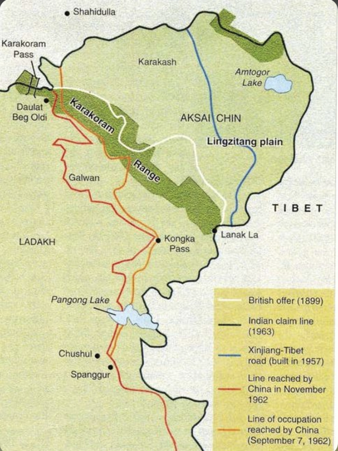
Okay let me put it this way - Is the above map correct in how it shows the Karakorum range and the LAC ? It depicts the LAC to the West of the Karakorum range.
The above map is not correct in so far the main Karakoram Range is depicted.
Karakoram Ranges emanates from Karakoram and Runs Wests of Upper Shyok and East of Nubra - Shyok running down to Nyoma. The one shown here is also part of Karakoram but extensions of the main range - such as Karakash, Chip Chap, Cheng chenmo and then Kailash Ranges... Technically all those are part of Karakoram. The Karakoram as a whole has deep valleys of Chip Chap, Galwan and Chendchenmo rivers.
Ladakh as it is bound from East to East by Kun Lun, Karakoram, Ladakh, Zanskar and then Greater Himalayan ranges.


 i think its more like inside the range.