- Joined
- Jun 5, 2017
- Messages
- 16,330
- Likes
- 70,173
Jai bajrang bali
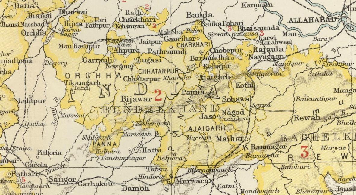
After Independence it became part of Vindhya Pradesh. Now it's part of Madhya Pradesh.
______________________________________

Jai bajrang bali
After Independence it became part of Vindhya Pradesh. Now it's part of Madhya Pradesh.


At its greatest extent, the Bombay Presidency comprised the present-day state of Gujarat, the western two-thirds of Maharashtra state, including the regions of Konkan, Desh, and Kandesh, and northwestern Karnataka state of India; it also included Pakistan's Sindh Province (1847–1935) and Aden in Yemen (1839–1939).[1] The districts and provinces of the presidency were directly under British rule, while the internal administration of the native or princely states was in the hands of local rulers. The presidency, however, managed the defense of princely states and British relations with them through political agencies.The Bombay Presidency was bounded on the north by Baluchistan, the Punjab and Rajputana; on the east by Indore, the Central Provinces and Hyderabad; on the south by Madras Presidency and the Kingdom of Mysore; and on the west by the Arabian Sea. Within these limits were the Portuguese settlements of Goa, Daman and Diu, and the native state of Baroda which has direct relations with the government of India; while politically Bombay included the territory of Aden, in present-day Yemen. The total area, including Sind but excluding Aden, was 188,745 sq mi (488,850 km2), of which 122,984 sq mi (318,530 km2) were under British and 65,761 under native rule. The total population was 25,468,209 in 1901, of which 18,515,587 were resident in British territory and 6,908,648 in native states.


