ISRO General News and Updates

Indx TechStyle

Kitty mod
Mod
Joined
Apr 29, 2015
Messages
18,287
Likes
56,238
Country flag
India's Commercial Space Program: What Makes It A Thriving Market

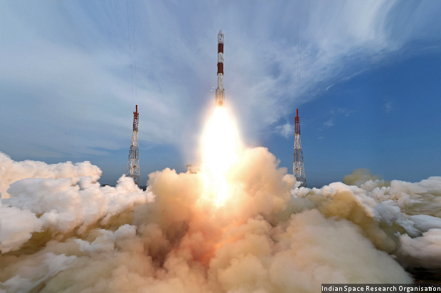
Rocket lift off. (Image used for representation only.) tpsdave / Pixabay CC0
Earlier this week, on Monday, a rocket with eight satellites was launched in one go by India. In a similar launch in June, a standalone rocket was used to send 20 satellites in a single mission, a feat that is counted amongst the most ambitious programs of the country. A number of the satellites launched were foreign, and the recent event increases the tally of foreign satellites launched by the nation to 79.
India seems to be clearly marching ahead in its space ambitions, and the country has already earned more than $120 million by launching satellites belonging to other nations, not to mention securing many other such deals.
The country's capability of launching numerous satellites simultaneously in a single mission has definitely cemented its footing in the global market. There are numerous private companies that develop satellites but are unable to launch them independently due to lack of funds. As a result, those firm piggy back on agencies like theIndian Space Research Organisation (ISRO), due to the latter's launch facilities.
According to ISRO, the reason why they are sought after is because their operations are cost effective. "We will be able to maximize our returns by making use of the excess space available in the vehicle while we are launching the satellites we make for our national requirements," adds AS Kiran Kumar, ISRO chairman.
One more thing that works in ISRO's favor is its ability of meeting deadlines and also the frequency of its launches. In fact, as per reports, the country plans on having as many as 12 launches in a year, a number that has clearly doubled since 2015. However, it is not always a smooth ride to tap into the foreign market due to regulatory hurdles as well as legal, contractual and export control complications. There is also steep competition, not only from other countries with advanced space programs but also private firms like Elon Musk's SpaceX.
Another detractor that is holding back India from raking in more space business is the fact that its Geosynchronous Satellite Launch Vehicle (GSLV) is used only for launching domestic satellites and not foreign ones, which are usually restricted to the small and light satellites that can be launched using the Polar Satellite Launch Vehicle (PSLV) - which is what the current small operators have been making a beeline for. However, if India can start to successfully launch more of heavy satellites, then there is no holding it back from escalating in position in the space industry, or making billions of dollars in the process.
 

Indx TechStyle

Kitty mod
Mod
Joined
Apr 29, 2015
Messages
18,287
Likes
56,238
Country flag
Record Satellite Launches In 2016, Foreign Craft Dominate

India’s Polar Satellite Launch Vehicle, PSLV-C35, was launched from the Satish Dhawan Space Centre, Sriharikota, on September 26, 2016, with eight satellites–five foreign and three Indian. India earned 205% greater revenue in financial year 2014-15 (Rs 415.4 crore) than the previous year (Rs 136 crore) for satellite-launch services.
The Indian space programme launched 10 satellites in 2016, three times more than the preceding year and the most ever, according to Indian Space Research Organisation data.
The September 26, 2016, launch of the Polar Satellite Launch Vehicle (PSLV)-C35 set two records: it was the longest satellite-launch mission yet, two hours, havingcompleted its previous mission in just under 30 minutes on June 22, 2016 (another benchmark occasion with the launching of 20 satellites in one go); and the rocket released eight satellites–five foreign and three Indian–into two orbits, something the Indian Space Research Organisation (ISRO) has not done before.
No more than 38% of satellites launched over the last 10 years have been Indian. Over 10 years, ISRO has had 34 launches, successfully sending up 121 satellites, 75 of them foreign: 18 (24%) were from USA, 11 (15%) Canadian, 8 (11%) each from Singapore and Germany, and 6 (8%) from the UK.
IMG_20160929_131844.JPG

Source: Indian Space Research Organisation
However, in terms of weight, the Indian satellites that ISRO has launched were 10 times heavier, by kg, than foreign satellites carried aloft by PSLV and other launch vehicles over the last decade.
Although foreign satellites (one US, one Canadian, and three Algerian) outnumbered domestic launches on Monday, according to the ISRO list of foreign satellites launched, Indian spacecraft occupied most of the 1,750-kg capacity of the PSLV, which completed its 36th successive, successful launch.
IMG_20160929_131935.JPG

Source: Indian Space Research Organisation
Up to 16% of the PSLV’s capacity was occupied by small satellites from foreign nations, who bought space on the Indian launcher. Deals are arranged by Antrix, the commercial arm of the Department of Space, and these are becoming more profitable by the year.
India earned 205% greater revenue in financial year 2014-15 (Rs 415.4 crore, or $62.3 million) than the previous year (Rs 136 crore, $20.4 million), and 704% more than in 2013 (Rs 51.3 crore, $7.7 million) for satellite-launch services.
On the most recent launch on Monday, the combined weight of the five foreign craft was 279 kg, the heaviest being the ALSAT-2B (117 kg), which is an Earth observation satellite meant to help Algeria with management of natural disasters and land planning, among other things.
The combined weight of the three Indian craft was 386 kg. The Indian SCATSCAT-1 alone weighs 371 kg. The SCATSCAT-1 is a government-owned craft intended to observe the earth, aiding weather forecasts among other things. It will operate for five years.
The other two weighed only 15 kg combined, and were from Indian Universities. The PRATHAM (10 kg) is from the Indian Institute of Technology (IIT) Bombay, and the PISAT (5 kg) is from PES University in Bengaluru. They are both conducting scientific experiments of their own.
If a satellite is heavier, assuming it is efficiently built, it is because of multiple payloads, indicating a greater amount of equipment to measure things more accurately or to measure different things. Consider the seven IRNSS spacecraft (1A-1G), all of which featured a separate payload for navigation and ranging. Each IRNSS weighed 1,425 kg, or 84% of the PSLV capacity.
The heaviest foreign satellite ever launched by ISRO was 400 kg, an Earth observation satellite from Singapore on December 16, 2015. Only 20% of Indian Earth observation crafts weighed less than that, and most weigh well over 1,000 kg.
India will benefit from the scientific experience of launching heavier craft, but it has also been suggested–by the BBC here–that foreign investors want Indian PSLV craft to take their heavy payloads instead, and that the commercial future of India’s space project could lie in that direction.
 

Akask kumar

Regular Member
Joined
Jan 28, 2016
Messages
583
Likes
666


Credit: @somnath SarJi,
Director of ISRO's Liquid Propulsion Systems Centre.:biggrin2:
there is one slide about HLV..
clearly it is shown that HLV is derivative of GSLV with modification as follows

central liquid Vikas engine will be replaced by SCE(semi cryo) with semi-cry0 fuel/tank(obviously).. the two solid booster is made smaller( as SCE is powerful than vikas engine)

so the fist stage is almost identical to the GSLV MK3(physically).. but totally different internally.

this modification was pointed out yesterday by hindu saying it will enhance the capability from 4 tonne to 6 tonne in 2018.

this HLV as shown has one extra stage, i.e. there are two upper cryogenic stages instead of 1 .. yesterday the hindu was talking about strap ons.. caliming this starp on addition will boost capability from 6 tonnes to 15 tonnes in 2020..i think they forgot to mention the two upper cryogenic stages.. because just adding strap ons dont boost the capability drastically..

so the Hindu article was talking about HLV without mentioning two upper cryogenic stages. if that thing taken into account then its acceptable that it will take two years(2018-2020) to boost the cap from 6 to 15 tonnes..

So HLV by 2020 and ULV after 2020
 

Indx TechStyle

Kitty mod
Mod
Joined
Apr 29, 2015
Messages
18,287
Likes
56,238
Country flag
About GSAT-18 from ISRO:
GSAT-18, India's latest communication satellite, is a high power satellite being inducted into the INSAT/GSAT system. Weighing 3404 kg at lift-off, GSAT-18 carries 48 communication transponders to provide Services in Normal C-band, Upper Extended C-band and Ku-bands of the frequency spectrum. GSAT-18 carries Ku-band beacon as well to help in accurately pointing ground antennas towards the satellite.
GSAT-18 is designed to provide continuity of services on operational satellites in C-band, Extended C-band and Ku-bands. GSAT-18 is launched into a Geosynchronous Transfer Orbit (GTO) by Ariane-5 VA-231 launch vehicle from Kourou, French Guiana. After its injection into GTO, ISRO's Master Control Facility (MCF) at Hassan takes control of GSAT-18 and performs the initial orbit raising maneuvers using the Liquid Apogee Motor (LAM) of the satellite, placing it in circular Geostationary Orbit.
After this, the deployment of appendages such as the solar panels and antennas as well as three axis stabilisation of the satellite will be performed. GSAT-18 will be positioned at 74 deg East longitude and co-located with other operational satellites. The designed in-orbit operational life of GSAT-18 is about 15 years.
GSAT-18 is scheduled to be launched on October 05, 2016 between 02:00 Hrs – 03:15 Hrs (IST) from Kourou, French Guiana by Ariane-5 VA-231. For more information on launch, Visit Arianespace…
Launch Mass:
3404 kg
Mission Life:
About 15 years
Power:
6474 W from Solar arrays, Two 144 Ah Li-Ion batteries
Ariane-5 VA-231
Type of Satellite:
Communication
Manufacturer:
ISRO
Owner:
ISRO
Application:
Communication
Orbit Type:
GSO
GSAT-18
Related News
 

Indx TechStyle

Kitty mod
Mod
Joined
Apr 29, 2015
Messages
18,287
Likes
56,238
Country flag
Surgical Strikes: First major use of Cartosat images for Army
IMG_20160930_161404.JPG
Representative image Surgical strikes: In a first, Army put to use ISRO's satellite images
HIGHLIGHTS
  • The surgical strike was facilitated by ISRO's Cartosat images
  • Cartosat images are called ‘eye in the sky’
  • This satellite can click pictures of areas of interest, record videos of sensitive targets from space, compress it, and relay it back to earth
BENGALURU: In what's being described as the first major use of the Cartosat family of satellites, the last one (2c) launched in June this year, sources in ISRO said that the armed forces were aided by high-resolution images for the surgical strikes conducted across the line of control (LoC) in the small hours of Thursday.
A source in ISRO said: "We've been providing images to the armed forces, the army in particular. While I cannot comment if any specific image was sent on a particular day in the previous week, I can say that Cartosat images are meant for this purpose and the army has used this."
Both ISRO and the Ministry of Defence (MoD) have largely remained tight-lipped about the uses of the Cartosat family of satellites—which experts call India's 'eye in the sky'—built for dual use.
The Cartosat-2C in particular added more teeth to India's military surveillance and reconnaissance capabilities, and has been providing high resolution images of 0.65 metres, an improvement over the 0.8m resolution of the earlier missions.
Area of Interest Images
"Cartosat also provided Area of Interest (AOI) based images for the armed forces," the source said. Another explained that based on requests, one or more scenes/images covering the AOI as specified is provided in as a single polygon (all the areas in one circle) in the form of a shapefile (non-topological geometry and attribute information for the spatial features).
According to the National Remote Sensing Centre (NRSC) in Hyderabad, AOI products are of two types—standard and precision-based ortho (where images taken from space are corrected to have an uniform scale—both of which are useful for the armed forces. Ortho rectified products are corrected for terrain distortions and camera tilt effects.
While the first Cartosat was launched in 2005, Cartosat-2A launched in 2007 was the first dual-use satellite with capabilities of monitoring missile launches in India's neighbourhood.
And, the Cartosat-2C is the best in the class that India boasts of although countries like the US and Israel boast of better ones. This satellite can not only click pictures of areas of interest, but also record videos of sensitive targets from space, compress it, and relay it back to earth.
For the main thread about the Surgical Strikes:
http://defenceforumindia.com/forum/...cal-strikes-across-loc-dgmo-29-09-2016.77482/
 

Indx TechStyle

Kitty mod
Mod
Joined
Apr 29, 2015
Messages
18,287
Likes
56,238
Country flag
'Couldn't be more proud, ISRO tech helped nation'
Two ISRO scientists attending a city tech-fest explain the technology behind the surgical strikes by India in Pak-Occupied-Kashmir.

Ratan Singh Bisht says the satellite serves a multitude of purposes. Pic/Atul Kamble
While the role of the military in a cross-border skirmish is paramount, equally important is the technology assisting them when in enemy territory. A stark example of that would be the CARTOSAT 2C, a satellite launched by ISRO in June this year that provided high-resolution pictures to the Indian Army and played a vital role in the successful surgical strike across the LoC yesterday.
“It’s a great achievement for us, the imagery produced by ISRO was used for the benefit of the nation, we couldn’t be more proud. Not just this, with the help of this satellite and the high-resolution camera, urban management, rural management and even illegal mining can be captured,” said ISRO scientist Ratan Singh Bisht. He was accompanied by retired ISRO scientist JP Joshi; both were part of the Mangalyan Mission.
How does the satellite work?
Based in ISRO, Ahmedabad, the scientists were in Mumbai for an Engineering tech-fest ‘Abhiyantriki’ held at Somaiya College.
Talking about satellites like CARTOSAT, which tend to provide crucial data of countries, Joshi, a former communication satellite scientist with ISRO, said, “There is a common understanding between countries over the world. If you are on a terrace, you can see everything, but if your parents tell you not to look into the neighbours’ homes, you won’t. These satellites are capable of viewing one third of the globe. Having said that, Pakistan is right at the border, and a satellite is like a torch, so it’s obvious that we can view their land. Area of Interest (AOI) is always known and defined in advance in such cases. As of now, Pakistan only has two such satellites, and those too are on hire from others.”
 

Indx TechStyle

Kitty mod
Mod
Joined
Apr 29, 2015
Messages
18,287
Likes
56,238
Country flag
Post Launch Updates from SCATSAT-1:
Post Launch Updates
September 29, 2016

3. Deep space Calibration carried out

2. Calibration over Greenland (cal val site) carried out

1. Scatterometer Scanning Mechanism (SSM) main mode ON in Radiometric Mode

September 28, 2016
3. Radiometric mode Calibration over Antarctica (cal val site) carried out.

2. Radiometric mode Calibration over Amazon (cal val site) carried out.

1. Radiometric mode Deep space calibration carried out.

September 27, 2016
4. Calibration for brightness temperature was carried out over Green Land. (cal val site)

3. Deep space Radiometric calibration operation carried out.

2. First payload data downloaded over Antarctica station.

1. Scatterometer Scanning Mechanism (SSM) in Redundant Mode initiated

September 26, 2016
3. Scatterometer initial configuration completed

2. Successfully acquired 3 Axis Attitude stabilisation

1. Successfully deployed Solar Panels and Hold Down & Release Mechanism of Scatterometer Antenna


First day Scatsat-1 data


Brightness Temperature H Pol: Orbit 16


Brightness Temperature V Pol: Orbit 16

Courtesy: ISRO - Government of India
 

Prashant12

Senior Member
Joined
Aug 9, 2014
Messages
3,027
Likes
15,002
Country flag
ISRO in service of the Indian soldier, Indian war machine

NEW DELHI: The precision 'surgical strikes' that Indian soldiers carried out on terrorist camps across the Line of Control were ably assisted and facilitated by metallic birds flying high in the sky unseen by Pakistanis and at least half a dozen satellites helped prepare and execute them.

India is fast developing a huge capability called 'C4ISR' or 'command, control, communications, computers, intelligence, surveillance, and reconnaissance'. The country has already put in place an Aerospace Command and experts who understand the nature of the 'surgical strikes' acknowledge that this new tri-services body played a key role in planning and execution of the midnight attacks.

The Indian Space Research Organisation (ISRO) evidently does not fight wars and is purely a civilian agency, but the capabilities it imparts to the nation are among the very best in world. From watching over with an eagle eye the terrorist and militant infra-structure in Pakistan to providing two way communication in desolate places to giving out accurate navigation signals, ISRO has built a formidable infrastructure that helps India protect its borders in day or night.

Not many Indians know of these deep capabilities that lie hidden within the portals of the space agency as ISRO's missions to Mars and Moon hog the lime light, but silently and steadily the 17,000 strong work force of ISRO contributes to keeping the lives of 1.2 billion Indians secure.

ISRO provides the necessary platforms, and then it is the user agencies that utilise its downstream products which means ISRO does not directly participate in the conflict.

K Kasturirangan, former chairman of ISRO, says "The space agency has a formidable suit of technologies and all are suitably deployed with each user agency utilising the assets to their best advantage."

So a high resolution imaging satellite can help in urban planning while it can also monitor terrorist camps across the border. Kasturirangan says a satellite image does not distinguish between friend and foe that interpretation rests with the users.

Nobody doubts that ISRO's eyes and ears facilitated 'surgical strike' in Pakistan Occupied Kashmir (PoK) at the staging points for terrorists. In years to come the role of India's space assets will play a much bigger role if and when hostilities break out on our borders.

Kiran Kumar, chairman of ISRO, says, "The Indian space agency will not be found lacking in helping secure India's national interests now and in future."

Today, India has 33 satellites in orbit around the earth and one in the Martian orbit. These include 12 communications satellites; 7 navigation satellites; 10 earth observation satellites and 4 weather monitoring satellites. This is one of the largest constellation of satellites in the Asia-Pacific region. Each bird is tailor-made for a specific purpose and each when needed helps protects India's supreme national interests.

India has some of the sharpest eyes in the sky and to prepare for the 'surgical strikes' India's best bird in the sky, the Cartosat 2-series satellite launched as recently as June 22 played a key role.

From its 526-km perch, this bird can peer at every object in Pakistan and can easily count the number of cars parked in the grand mansion of Pakistani Prime Minister Nawaz Sharif. With its almost 0.65-m resolution as it rotates the earth every 90 minutes this formidable spy in the sky can count each and every tank, truck and fighter aircraft parked anywhere in Pakistan or for that matter anywhere India desires.

Speaking about the capabilities of this ultra-sharp satellite, Kumar said "The Cartosat 2 series has a unique capability of capturing a 1-minute video, which despite its enormous speed of 37 km a second, is able to focus at a single point for a minute."

In addition, there were three other earth imaging satellites Cartosat-1, Cartosat-2 and Resourcesat-2 that provide top class imagery during day time. Going further, ISRO seeks to develop satellites that have a resolution of 25 cm in the very near future.

In contrast, Pakistan has no such capability as its space program has hardly lifted off. Former ISRO chairman G Madhavan Nair says even China does not have such high resolution satellites, the best China has is about 5-m resolution.

Nair says "India invested heavily in space imaging technology and is now reaping the benefits."

India also flies some satellites that have day and night viewing capabilities called 'synthetic aperture radar satellites'. There are two in orbit, the RISAT-1 and RISAT-2. Nothing can hide from these mean birds as they can see through cloud cover and are not blinded at night. Especially RISAT-2 is among the best in its class and its revisit time is relatively short.

Assessing damage on the camps that harboured the terrorists would be relatively easy using the radar satellites. It is not that these satellites do not help civilian activities, radar satellites help monitor floods and have even been deployed to search for crashed planes and helicopters.

India has put in place a regional satellite navigation system called NAVIC as recently as April 28 -- the last of the seven satellites was launched -- and Prime Minister Narendra Modi spoke on its huge benefits.

This system gives better than 20-m accuracy for navigation signals akin to the American Global Positioning System (GPS) in an envelope which extends about 1,500 km from the border on all sides.

The signals are being beamed down 24x7 all the year around. Only America and Russia have similar capability over the South Asian region, China is still putting in place its satellite navigation system.

The restricted signal which is available to the Indian armed forces is supposed to be even more accurate than the American GPS in the Indian region. Experts say it is unlikely that the Indian special forces used the hand-held devices from NAVIC to guide them to the terrorist camps as the devices are still being fine-tuned.

India's enemies should have no doubts that very soon these swadeshi GPS signals will be leading its commandos into the very den of masterminds who control the terrorists. In the event of an all-out war, signals from NAVIC will undoubtedly help India target its whole suite of missiles to unleash unprecedented punishment on the enemy. Since the satellite navigation system is in India's control there can never be any fear of someone switching the constellation off.

There is another over 2,000 kg bird that points towards the Indian region all day and all night and provides unprecedented capability to India's armed forces. This is a satellite called GSAT-6 and this unique satellite has multi-media capability as it can stream video in both directions. It has the largest antennae which is 6 m in diameter. This is one unique satellite which will play a crucial role in the network centric warfare of the 21st century.

Using a hand-held device, individual soldiers can connect and will be able to transmit live pictures of what they can see from their helmet mounted cameras even as they engage in combat. Launched last year the users are still developing the handheld devices that can be made portable and compatible with this capability. Very soon this satellites twin GSAT-6 A may be flown which will have even more powerful capabilities.

Nair says, "The government and ISRO should expedite development of GSAT-6 A to have special capabilities that the special forces need."

If one recalls in 2011, it was shown that President Barrack Obama monitored live feeds of the surgical strike the US carried out as part of Operation Geronimo to eliminate Osama bin Laden in Pakistan. India's GAST-6 and GSAT 6 A both will in principle be able to help providing live signals from the remotest of remote places in India's neighbourhood.

Sources in India's Aerospace Command confirm that they did have access to a live feed that was put in place using typical Indian 'jugaad' but with these satellites such capabilities will become common place.

Nair says right now India relies heavily on using Thuraya handsets for satellite telephony but he hopes very soon the Defence Research and Development Organisation (DRDO) will be able to deliver Indian handsets that are compatible with the country's GSAT-6 satellite.

In fact Nair insists that in the upcoming GSAT 6-A, satellite telephony should be made the bigger component.

While understandably much of the resources are focused on land since India has hostile neighbours both on its western and eastern fronts. ISRO has not forgotten the deep blue oceans that surround India and they need to be protected as well. On a specific demand by the Indian Navy, the Indian space scientists have already deployed a satellite the Navy calls 'Rukmini'. This is a dedicated communications satellite which helps the Indian Navy talk to its ships when they are beyond the visual range, in a secure fashion.

In coming years, ISRO will also deliver a dedicated satellite made for the Indian Air Force. Modi is a known space buff who even monitors India's rocket launches even as he goes about executing his day to day parliamentary duties and he is well aware how and where to deploy India's space assets to make sure no one casts an evil eye on India.

Yet among all this one chink remains space infrastructure is very vulnerable to attacks of the star wars type. Hence having boots on the ground that can protect the boundary will always be necessary.

http://economictimes.indiatimes.com...r-indian-war-machine/articleshow/54638711.cms
 

Indx TechStyle

Kitty mod
Mod
Joined
Apr 29, 2015
Messages
18,287
Likes
56,238
Country flag
Story of the Week - Indian Space Research Organization
AstroSat Completes One Year in Orbit

The Indian multi-wavelength space astronomy observatory AstroSat has completed one year in orbit on September 28, 2016. The spacecraft has orbited the Earth more than 5400 times and has executed 343 individual pointings to 141 different cosmic sources. During this scientifically rewarding one-year, several celestial sources have been observed and studied in detail. The results obtained are as expected and scientific findings are being published. The satellite is functioning normal and all the state-of-the-art world-class payloads are being operated as planned. A science meet was organized at IUCAA on September 29, 2016 to commemorate the one year completion of AstroSat.
AstroSat observes the Universe in optical, near and far Ultraviolet and X-ray regions of the electromagnetic spectrum. The interesting feature is the simultaneous multi-wavelength capability on the same satellite platform. These studies are being extended by co-ordinated observations using other spacecrafts and ground based observatories.
The first six months were dedicated to performance verification and onboard calibration of payloads indicated, which has shown that all the payloads conformed to the designed parameters. The first set of scientific observations have been completed from April to September 2016 as guaranteed time for the payload teams.
Some of the salient science observations are:
  • Large Area X-ray Proportional Counter (LAXPC) has observed rapid variability of high energy (particularly >20keV) X-ray emission from a black hole system, GRS 1915+105 for the very first time.

Figure shows the power density spectrum for the source GRS 1915+105. As seen in the figure, Quasi periodic oscillations (QPOs) at 2.55 Hz are observed in the energy band 20 – 80 keV for the first time. This QPO changes in frequency as the flux of the source changes.
LAXPC, also measured the arrival time difference between the high and low energy X-rays (which is of the order of tens of milli-seconds). This provides direct clues to the geometry and dynamic behavior of the gas swirling around a spinning black hole (Ref: arXiV:1608.07023 [astro-ph.HE]). A publication based on the above results is accepted in Astrophysical Journal.
The Cadmium Zinc Telluride Imager (CZTI) normally operates in the energy range 15 – 100 keV. At higher energies, the Field of View of this imager becomes wide and therefore it can detect Gamma Ray Bursts (GRBs). These are transient gamma ray events that can occur at any time, in any part of the sky, and are considered to arise at cosmological distances beyond our Galaxy. CZTI has detected over 40 GRBs. CZTI has demonstrated capability to detect polarization in GRBs.

Figure above shows the identified events corrected for geometry contributing to the GRB 1510016A (in black) as a function of azimuthal angle. The red solid is the fit to the modulation curve. The fitted modulation factor is 0.32 with the detection significance of 1.5 sigma.
The scientific details will be published shortly in the Astrophysical Journal (Ref :arXiV:1608.07388 [astro-ph.HE]. Polarisation properties and their relation to the spectral evolution have potential to clearly distinguish between various models of GRB prompt emission mechanism.
Polarisation estimates are being undertaken for Crab and several other X-ray sources.

  • Ultraviolet Imaging Telescope (UVIT) observed the field stars in the open cluster NGC 188. One source which was earlier thought to be a sub-dwarf is found to be a binary with sources having temperatures around 12500K and 5750K.
  • Scanning Sky Monitor (SSM) observed the X-ray pulsar 4U0115+63 in its outburst phase and the pulsations of 3.6 seconds were detected.
  • Soft X-ray Telescope (SXT) detected the continuum and lines from bright Supernova Remnant such as Tycho. The advantage of having a good spectral resolution along with large field of view is expected to be extremely important to study the clusters of galaxies.
Regular Satellite Tracking and data processing is being done at ISRO. The data is distributed to the scientific community by the Indian Space Science Data Centre (ISSDC).
An announcement of opportunity (AO) was made in June 2016 through ISRO website, for Indian scientists/ researchers working at institutes/Universities/colleges to submit proposals. The proposal entry and review is done online through AstroSat Proposal Processing System (APPS) software developed for this purpose. A total of 59 Indian proposals have been accepted and observations have started.
ISRO, in collaboration with IUCAA, has established an AstroSat support Cell (ASC) at IUCAA, Pune, considering the imperative long term scientific support for AstroSat and to train the young scientists to explore possibilities for proposal submission and data analysis. This cell was formally dedicated by Chairman, ISRO to the scientific community on the occasion of one year completion of AstroSat.
Details on the science meet organized at IUCAA to commemorate the one year completion and the posters released during the event is available at ISRO Website.
Story of the Week - Archive
Oct 03, 2016 : AstroSat Completes One Year in Orbit
Sep 26, 2016 : SCATSAT-1 – Satellite for Weather Forecasting, Cyclone Detection and Tracking
Sep 19, 2016 : Updated Flood Hazard Atlas for Assam State
Sep 12, 2016 : Bengaluru Space Expo (BSX)-2016
Sep 06, 2016 : MoU signed for Transfer of Technology for Manufacturing of HMC DC-DC Converters
Aug 29, 2016 : ISRO’s Scramjet Engine Technology Demonstrator Successfully Flight Tested
Aug 22, 2016 : RAPID: Gateway to Indian Weather Satellite Data
 

shiphone

Senior Member
Joined
Nov 9, 2009
Messages
2,163
Likes
2,479
Country flag
India has some of the sharpest eyes in the sky and to prepare for the 'surgical strikes' India's best bird in the sky, the Cartosat 2-series satellite launched as recently as June 22 played a key role.

From its 526-km perch, this bird can peer at every object in Pakistan and can easily count the number of cars parked in the grand mansion of Pakistani Prime Minister Nawaz Sharif. With its almost 0.65-m resolution as it rotates the earth every 90 minutes this formidable spy in the sky can count each and every tank, truck and fighter aircraft parked anywhere in Pakistan or for that matter anywhere India desires.

Speaking about the capabilities of this ultra-sharp satellite, Kumar said "The Cartosat 2 series has a unique capability of capturing a 1-minute video, which despite its enormous speed of 37 km a second, is able to focus at a single point for a minute."

In addition, there were three other earth imaging satellites Cartosat-1, Cartosat-2 and Resourcesat-2 that provide top class imagery during day time. Going further, ISRO seeks to develop satellites that have a resolution of 25 cm in the very near future.

In contrast, Pakistan has no such capability as its space program has hardly lifted off. Former ISRO chairman G Madhavan Nair says even China does not have such high resolution satellites, the best China has is about 5-m resolution.
wow....very very Indian style....lol..such Brave Words even from an senior ex-scientist..

1. JiLing-1 satellite's real time dynamic tracking -- so called video...lol


2. 5-m resolution? wow, right now there are two 0.5M resolution optics and one 0.5m SAR working in orbit of the china in-orbit spacecraft fleet...and these Sats are for the civilian and commercial use, the data by the military spacecrafts in orbits are always classified

----------
after a decade of observation, I really can't understand why Indian enjoying talking about China with loads of ignorance and making comparing here and there...

these are two totally different civilization on the earth although they are neighboring. it seems that the Himalayas is too high...lol
 
Last edited:

ezsasa

Designated Cynic
Mod
Joined
Jul 12, 2014
Messages
31,926
Likes
148,105
Country flag
after a decade of observation, I really can't understand why Indian enjoying talking about China with loads of ignorance and making comparing here and there...

these are two totally different civilization on the earth although they are neighboring. it seems that the Himalayas is too high...lol
If pakis were technologically comparable to India, we would have been talking more about them. Since that is not the case, the other neighbour is being discussed.

Anyways, how is it a bad thing to compare with other countries? You guys compared yourself with America for more than two decades.
 

Akask kumar

Regular Member
Joined
Jan 28, 2016
Messages
583
Likes
666
wow....very very Indian style....lol..such Brave Words even from an senior ex-scientist..

1. JiLing-1 satellite's real time dynamic tracking -- so called video...lol


2. 5-m resolution? wow, right now there are two 0.5M resolution optics and one 0.5m SAR working in orbit of the china in-orbit spacecraft fleet...and these Sats are for the civilian and commercial use, the data by the military spacecrafts in orbits are always classified

----------
after a decade of observation, I really can't understand why Indian enjoying talking about China with loads of ignorance and making comparing here and there...

these are two totally different civilization on the earth although they are neighboring. it seems that the Himalayas is too high...lol
i agree the ex- ISRO scientist made a wrong statement.. and even u hav made a wrong statement neither its 5m or .5m its 0.72 m..

The fourth, designed for commercial use, carries a camera capable of producing images with a 72-centimeter ground resolution when looking straight down.
http://spacenews.com/china-launches-high-resolution-commercial-imaging-satellite/

please , spare this threat from china india or india paksitan hatred and bigotry. we discuss news just about ISRO and realted space science..

if u want to make correction simply put it without adding hatred spice..
chill..
 

Latest Replies

Global Defence

New threads

Articles

Top